
Διαβάστε το άρθρο στα ελληνικά.
The Greek forest map (δασικός χάρτης): codes, αναδασωτέα and how to check a plot yourself
On this page
The check most likely to end a Greek land purchase, read from the official viewer: every character code in the published legend, where αναδασωτέα actually hides, and four real parcels with four different answers.
This guide is a preliminary screen for a purchase or permit question, not legal, surveying, engineering or tax advice; read the full scope and limits before relying on it.
A buyer we ran a report for last month was looking at 4,905 m² on the Trikeri peninsula in Magnesia: olive terraces, a track running to the door, a view down to the Pagasetic Gulf. The official forest map returns ΔΔ for it. Forest in 1945, forest again at the second reading, the whole plot inside the ratified polygon. Nothing about standing on that land tells you so.
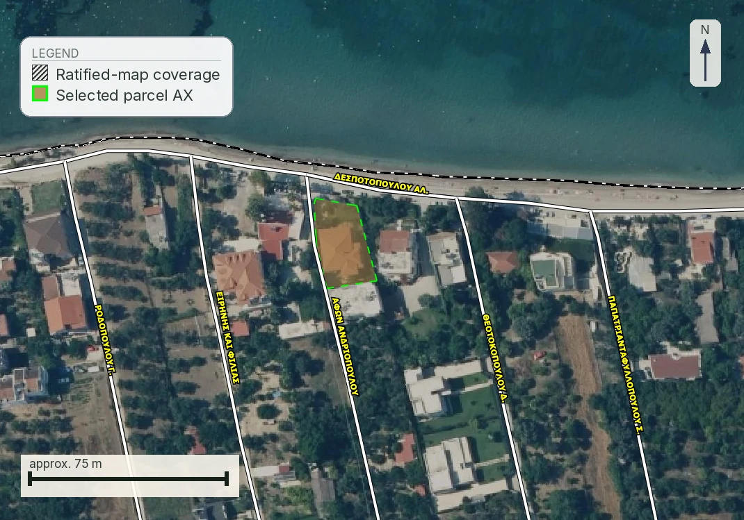
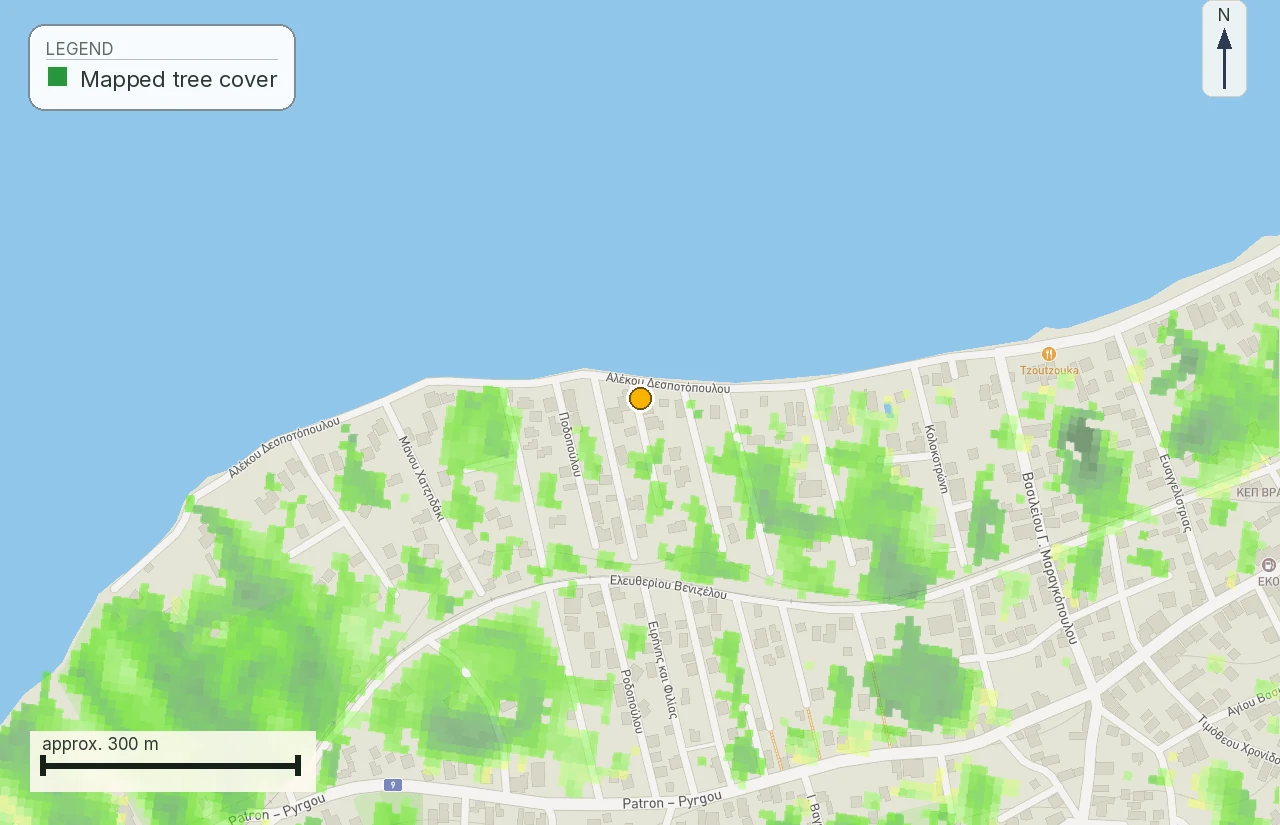
The picture at the head of this page is a LandCheck section map drawn from the forest-map coverage layer over satellite imagery. It provides screening evidence and does not reproduce an official viewer extract. Every image below it is a screenshot of the official viewer or a page from one of our own reports, captioned with its source and capture date.
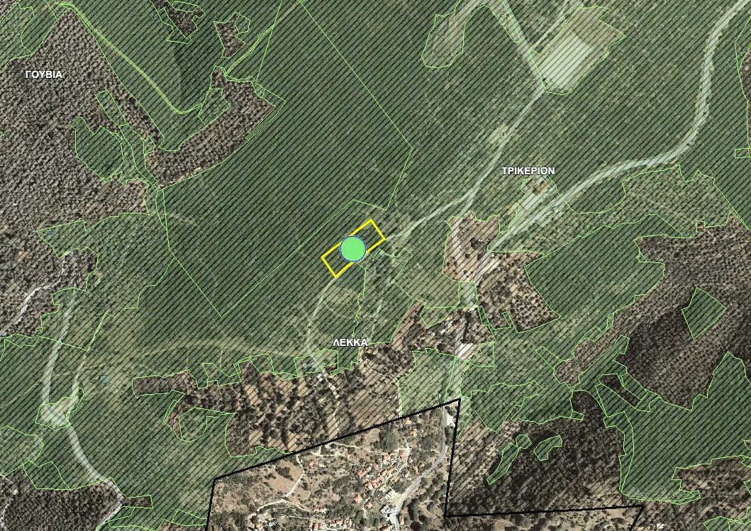
This is the check most likely to end a Greek land purchase outright, and the one buyers skip most often, because the plot in front of them looks like farmland. What the map records is what the aerial photography showed, and that record binds whatever has grown or been cleared since.
What the δασικός χάρτης is, and what gives it force
The forest map is the national record of which land falls under forest legislation. It is compiled by reading aerial photography from 1945, or 1960 in some prefectures, against recent imagery and field inspection, and assigning every polygon a character. The substantive law behind it is Ν. 998/1979 on the protection of forests and forest land; the procedure that produces, posts and ratifies the maps themselves is Ν. 3889/2010, which has been amended repeatedly since.
The map is compiled, posted and put forward for ratification by the Διεύθυνση Δασών of the Αποκεντρωμένη Διοίκηση for the area, and the ratification decision is issued at that level; it is published through the Hellenic Cadastre's application. The Δασαρχείο is the local forest service you deal with for individual acts on the ground, such as a πράξη χαρακτηρισμού. Keeping the two apart saves a wasted trip: a question about the map goes to the Διεύθυνση Δασών. The seller's assurance that "it has always been farmed" carries no weight against either of them.
Two terms sit underneath everything that follows, and άρθρο 3 παρ. 1 and 2 ν. 998/1979 separate them. Δάσος is the denser, self-sustaining woodland ecosystem; δασική έκταση is the same organic relationship between vegetation and ground at lower cover. Both attract the building prohibition. The distinction decides what management is permitted and how a case is argued. It does not decide whether you may build a house. When an agent calls the plot "only scrubland", ask which code the map carries: χορτολιβαδική land has its own restrictions under the same law.
What the classification forbids, and what it still allows
A forest character restricts changing what the land is, more than it restricts using it as it stands. The permissions run by activity, under Ν. 998/1979, and existing lawful use is treated differently from anything new. In practice:
- Building a house: no. A ΥΔΟΜ cannot issue a permit for a dwelling on land the forest map carries as δασικό. The prohibition is drawn from άρθρο 24 παρ. 1 of the Constitution, which puts forests under state protection, and worked out in the permitted interventions of άρθρα 45–61 ν. 998/1979 (ΦΕΚ Α΄ 289), which do not include a dwelling. That is why no local authority can waive it.
- Change of use: only through a named exception, and the names are narrow. Read what άρθρα 45–61 actually cover. Άρθρο 47 παρ. 1, «γεωργική εκμετάλλευση», opens with a flat prohibition on εκχέρσωση of forest for farming and then allows it by exception, capped at 30 στρέμματα for an individual. Άρθρο 49 παρ. 1 covers «εγκαταστάσεις τουριστικού χαρακτήρα» on public forest land and names its categories: ski centres, thermal and thalassotherapy installations, four and five star hotels, golf courses. Παρ. 4 opens the same list on private forest land, and where the whole site is forest it sets a floor of 500 στρέμματα. Neither article is a development right that comes with the plot; each is a discretionary approval on its own file, with its own permit risk, and never the plan B for a residence.
- Forestry and grazing: generally yes, within the forest service's rules and often needing its approval for anything beyond maintenance.
- Ownership and transfer: yes. Private forest land exists and changes hands. What you own is forest land, and the deed will say so.
- Limited works: an approval, on the same footing as any other intervention. Άρθρο 45 παρ. 1 bars anything that changes the destination of forest land except what the chapter itself allows, and παρ. 2 makes every permitted intervention an έγκριση επέμβασης issued by the Γενικός Γραμματέας of the Αποκεντρωμένη Διοίκηση on the forest service's recommendation, or folded into the environmental decision (ΑΕΠΟ or ΠΠΔ) where one is required. A Δασαρχείο does not issue that decision. On private forest land the owner's written consent is required as well. A private access track falls under άρθρο 48 παρ. 3, which routes it through the ΑΕΠΟ or ΠΠΔ and then hands the road over to public use. Fire-protection works sit on the other side of the line: under άρθρο 16 they are the forest service's own programme, planned and executed by it, not something a landowner applies for. Fencing has no permitting article of its own in ν. 998/1979 that we could trace. The provision that catches it sits elsewhere: άρθρο 114 ν. 1892/1990 (ΦΕΚ Α΄ 101) bans the erection of «οικοδομές, κτίσματα και πάσης φύσεως εγκαταστάσεις» in forests, forest land and αναδασωτέες εκτάσεις, public or private, and orders what has gone up demolished. Ask the Δασαρχείο before you buy posts.
So a ΔΔ plot is a real asset with a narrow set of lawful uses, and it should be priced against what that narrow set is worth in that area.
Built from 1945, which is why it surprises people
The logic that makes the map counter-intuitive is that the 1945 photograph is the baseline. If the ground was forest then, the land is presumed to be forest land now, regardless of what has grown, been cleared, been ploughed or been built since. Clearing forest did not convert it. In most cases it created an offence and left the legal character untouched.
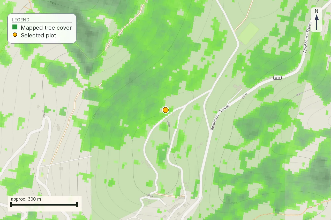
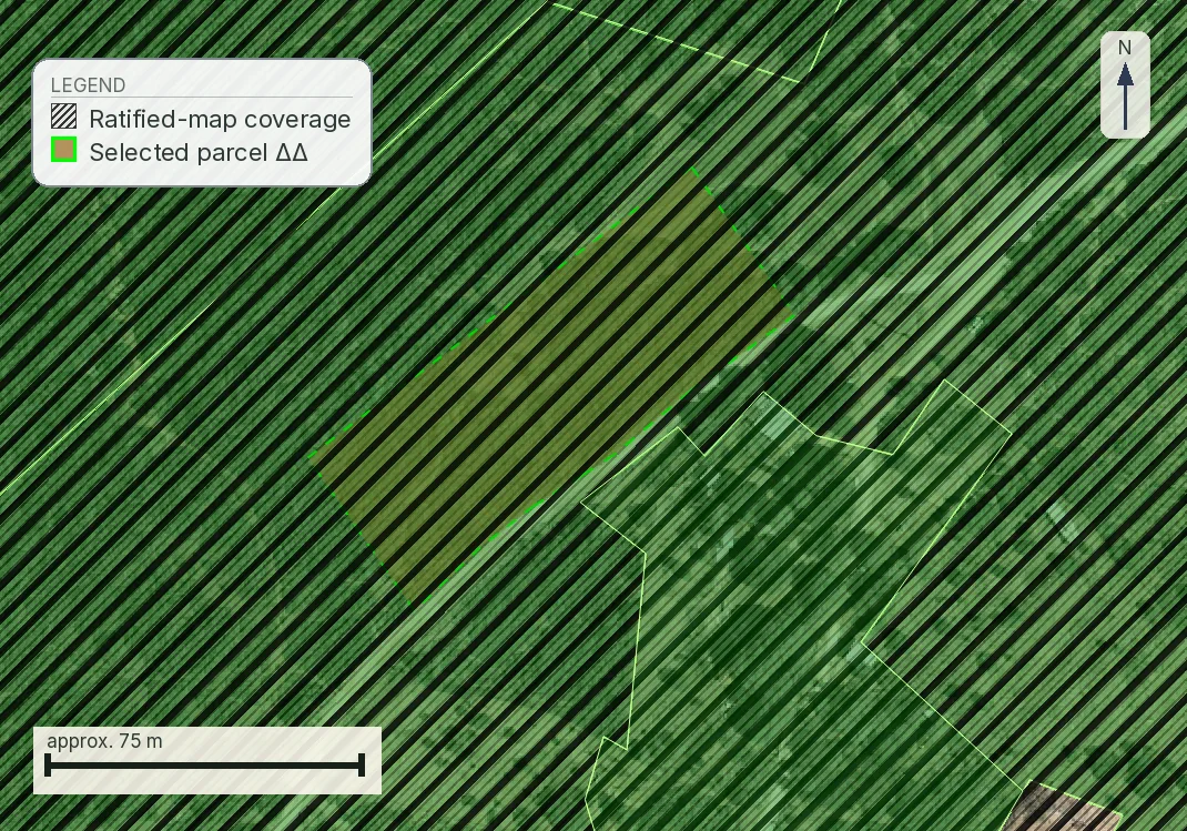
Here is the same Trikeri plot twice. On the left, current tree cover from satellite-derived land cover; on the right, the ratified forest map over the same ground.
How to check any parcel yourself, in about four minutes
You do not need us for this, and you should do it before you pay anyone for anything.
- Open gis.ktimanet.gr/gis/forestsuspension. It is the Hellenic Cadastre's forest-map posting viewer, and it is public.
- Find your parcel. If you have the KAEK, the viewer will usually locate it directly. Where it does not, the parcel is normally in an area still at the κτηματογράφηση stage, and you have to switch on the exhibition-phase cadastre layer before the search will resolve it. If you do not have the KAEK, use the address search and then the aerial imagery to find the boundary you were shown.
- Switch on the forest-map layer if it is not already drawn, and look for diagonal hatching over your plot.
- Click inside the plot. The viewer returns a small panel with the prefecture, the municipality and, where a map is posted, the line Χαρακτηρισμός έκτασης followed by a code.
- Click more than once. A parcel of any size can straddle a boundary, and a single click answers for a single point. It does not answer for the land you are buying.
That last step is not caution for its own sake. KAEK 330566403009 in Mytilene, 3,911 m², returns ΠΑ at one point inside it and ΑΑ at two others. One parcel, two characterisations, because the boundary runs through it. A buyer who clicked once and stopped would have had a true answer about a corner of the plot and a false impression of the rest.
The character codes, in full
Most explanations name three or four codes; the application's own published legend is longer. The code is two letters, historical reading first, current reading second, drawn from three classes: Δ for δάση και δασικές εκτάσεις, Α for άλλης μορφής εκτάσεις, Χ for χορτολιβαδικές εκτάσεις. Three classes make nine ordered pairs in principle; the legend carries the seven below, and we have not seen ΔΧ or ΧΔ in it. If a pair is absent from this table, email the Διεύθυνση Δασών before drawing a conclusion.
| Code | 1945 photography | Recent photography | What it means for you |
|---|---|---|---|
| ΔΔ | Forest | Forest | Forest on both readings. The strongest form of the finding and the hardest to argue with. |
| ΔΑ | Forest | Other form | Cleared at some point. The contested case: the map remembers forest, the ground shows a field. |
| ΑΔ | Other form | Forest | An afforested field — δασωμένος αγρός. Trees arrived after 1945 on land that was not forest. |
| ΑΑ | Other form | Other form | Not forest on either reading. The forest map does not restrict this land. |
| ΧΧ | Grassland | Grassland | Χορτολιβαδική on both readings. Its own regime, and not the same as ΑΑ. |
| ΧΑ | Grassland | Other form | Grassland in 1945, something else now. |
| ΑΧ | Other form | Grassland | The reverse of ΧΑ. |
What the second letter dates from. It is the more recent reference photography the map was drawn from: 2007–2009 for most of the country, stated per map sheet. Anything that has happened on the ground since, lawfully or not, is outside both readings. A code saying "grassland" does not certify that the plot is grassland this morning; it says that is what the second set of photographs showed.
Then a second family, which is a different kind of object. ΠΔ, ΠΑ and ΠΧ record that a τελεσίδικη πράξη χαρακτηρισμού (a final administrative characterisation act) has already settled the question for that polygon. The Π says a formal act exists; the second letter says how it came out. ΠΑ is the cleanest answer the viewer gives because a decision has already settled the character shown in the two photographs.
The grassland codes nobody explains
Χορτολιβαδικές εκτάσεις, grassland and scrub, are the part of the legend that buyer-facing explanations leave out, and the omission does real damage, because ΧΧ is not ΑΑ. Land that read as grassland on both photographs sits inside the forest service's remit under Ν. 998/1979, and what is permitted on it turns on distinctions the two-letter code does not show: observation code 29 marks ιδιωτικές χορτολιβαδικές, private grassland, and 30 marks πεδινές χορτολιβαδικές, lowland grassland.
If your code has a Χ in either position, ask a δασολόγος which grassland regime applies to that polygon. The split runs through άρθρο 3 παρ. 5 περ. α΄ ν. 998/1979 (ΦΕΚ Α΄ 289), as replaced by άρθρο 32 παρ. 4 ν. 4280/2014 (ΦΕΚ Α΄ 159). Terrain is the test; vegetation is not. That paragraph brings grassland under the law only where it lies «επί ημιορεινών, ορεινών και ανώμαλων εδαφών»: on semi-mountainous, mountainous or broken ground. Lowland grassland falls outside forest legislation because that wording omits it. There is no exclusion paragraph of its own, which is why the citation circulates two ways. Measurement draws the line between them; appearance alone does not. Π.Δ. 32/2016 (ΦΕΚ Α΄ 46/31.3.2016), the decree issued under άρθρο 3 παρ. 1, 2 and 5. Its άρθρο 5 παρ. 3 defines πεδινές χορτολιβαδικές negatively, as «μη ορεινές ή ημιορεινές και μη κείμενες επί ανώμαλων εδαφών», and sets three conditions that must all hold: elevation no higher than 100 m above sea level, mean slope no more than 8%, and maximum slope no more than 12%. Those are figures a surveyor can check off a contour map in an afternoon, so ask before anyone opens a file. One thing does stay open: whether φρυγανώδεις εκτάσεις belong inside forest legislation at all has been argued both ways before the Council of State, and we have not found a decision that settles it.
What decides this deal is whether the seller owns the land at all. Over ground that falls under forest legislation the Greek State asserts a presumption of ownership, so the burden of proving private title runs the wrong way for a buyer. Observation code 29, ιδιωτικές χορτολιβαδικές, is precisely a record that this question has already been answered in favour of private character. It is a strong indication. It does not prove that this particular seller holds title. Code 30, πεδινές, records that the ground is lowland, and on the reading above that puts it outside forest legislation altogether under άρθρο 3 παρ. 5 περ. α΄ ν. 998/1979: the one case where a Χ code leaves the forest service's remit. Both entries carry weight, and both still need the title chain read behind them.
The provision to name is άρθρο 62 ν. 998/1979, «Βάρος απόδειξης — Ειδική αναγνώριση κατατμήσεων», as replaced by άρθρο 37 παρ. 1 ν. 4280/2014. It does not use the word τεκμήριο; what it does is put the burden of proof on the private party in any dispute with the State over forest land, which comes to the same thing for a buyer.
And it does not apply everywhere. Its second sentence disapplies the rule in the areas served by the Πρωτοδικεία of the Ionian Islands, Crete, Lesbos, Samos, Chios, the Cyclades, Kythira, Antikythira and the Mani (the municipalities of East and West Mani). The Dodecanese were added by άρθρο 110 ν. 4821/2021 (ΦΕΚ Α΄ 134/31.7.2021), headed «Προσθήκη περιοχών εξαίρεσης από το βάρος απόδειξης εμπράγματου δικαιώματος», which inserts the words «της Δωδεκανήσου, πλην των νήσων που ισχύει ο κτηματολογικός κανονισμός». Read the carve-out inside the carve-out carefully: the islands still covered by the Italian-era Dodecanese cadastral regulation stay under the ordinary rule, so which Dodecanese island the plot is on decides the answer. If your plot is in one of the excepted areas, the State cannot lean on the rule and has to prove what it asserts like any other litigant, which changes the picture materially. If it is not, put it to a Greek property lawyer as an ownership question, in those words: a δασολόγος can establish what the land is, but ownership is decided on the titles.
Αναδασωτέα, and the field almost nobody reads
The strictest status on the map is αναδασωτέα: land declared for reforestation, usually after a fire. The protection is constitutional. Άρθρο 117 παρ. 3 requires burnt forest land to be restored to forest and forbids releasing it for another use, and the declaration procedure sits in άρθρα 37–44 ν. 998/1979 (ΦΕΚ Α΄ 289). Because the source is the Constitution, no permit and no administrative tolerance overrides it: it bars building and change of use, and it survives the fact that the ground is now bare. It is the status a buyer most needs to detect and the one most easily missed. The legend carries ΑΝ as its own class, «ΑΝΑΔΑΣΩΤΕΕΣ Ή ΔΑΣΩΤΕΕΣ ΕΚΤΑΣΕΙΣ», which covers ground designated for afforestation as well as ground to be restored after a fire; a plot can carry it without ever having burnt. What the class does not do is come back in the Χαρακτηρισμός έκτασης line when you click the parcel. It arrives in a separate field. Here is the viewer's own answer at two well-known post-fire areas in Attica, verbatim:
Πεντέλη   ΝΟΜΟΣ: ΑΤΤΙΚΗΣ · ΟΤΑ: ΠΕΝΤΕΛΗΣ
          Χαρακτηρισμός έκτασης: ΔΔ
          Επιπλέον Πληροφορία: ΑΝ,2

Μέγαρα    ΝΟΜΟΣ: ΑΤΤΙΚΗΣ · ΟΤΑ: ΜΕΓΑΡΕΩΝ
          Χαρακτηρισμός έκτασης: ΔΔ
          Επιπλέον Πληροφορία: ΑΝ
The character field says ΔΔ. The reforestation flag is the ΑΝ in Επιπλέον Πληροφορία, and if you read only the two-letter code you will never see it. We know this because our own report read only the two-letter code until 1 August 2026, and we fixed it the day we found out.
The number after the comma is an observation code from the same legend. Code 1 means the parcel sits εντός ορίων εποικισμού; code 2, inside a κτηματικός χάρτης boundary under ν. 248/1976. Code 28 is the one to look for: it marks land the state itself records as having lost its forest character before 11 June 1975, the date on which the 1975 Constitution's forest protection took effect. A ΔΑ with a 28 beside it is a different negotiation from a bare ΔΑ.
Ανάρτηση, αντιρρήσεις, κύρωση: which answer you are looking at
A forest map does not arrive finished. It is posted, objected to, and then ratified, and the weight of the code you read depends on where in that sequence your area sits.
A posted but unratified map is provisional and still consequential: permitting authorities work from it while objections are pending. A ratified map (μερικώς or ολικώς κυρωμένος) is binding until a court sets it aside. The viewer's click response tells you the code and the jurisdiction. It does not tell you which stage the area has reached, and that is a question for the Διεύθυνση Δασών or for the ratification decisions published by the Αποκεντρωμένη Διοίκηση.
When no map governs your land at all
Some areas have no posted forest map. The viewer answers «Η περιοχή είναι εκτός ανάρτησης», and this is not the same as a clean result. It means the check could not be run here, and a buyer who is told "the forest map came back clear" about such a parcel has been told something untrue.
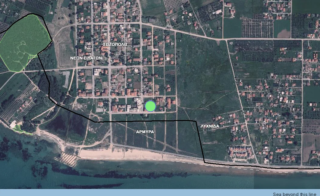
First establish which kind of "no map" you are looking at. «Εκτός ανάρτησης» has two very different causes, and the screenshot above shows why it matters: that black line is a settlement boundary. Either no forest map has been posted for the area at all, or, far more often close to a village, the point falls inside ground that is excluded from the forest map, typically an approved plan or a delimited settlement. Ask the Διεύθυνση Δασών in writing which of the two applies before spending anything, because the answer decides whether the next step even exists.
Where the area is genuinely unposted, the route is the πράξη χαρακτηρισμού under άρθρο 14 ν. 998/1979 (ΦΕΚ Α΄ 289): an application to the Δασαρχείο to characterise the specific parcel, prepared by a δασολόγος, decided by the forest service and open to appeal. It takes months. No statute makes it a condition of buying. That is exactly the problem: a sale in an unposted area is perfectly valid without one, so nothing in the transaction forces the question and it surfaces later at the ΥΔΟΜ. Treat it as the diligence step we would insist on before a deposit. Note the limit: άρθρο 14 was the temporary mechanism for the period before forest maps existed, and where a map has been posted the map and the objection procedure govern instead. Earlier τελεσίδικες πράξεις χαρακτηρισμού keep their force and should have been incorporated into the map; where one was not, you are in a correction case.
Objecting in practice
Check first whether the door is still open. An αντίρρηση runs against an exclusive deadline published with the posting (άρθρο 15 ν. 3889/2010, ΦΕΚ Α΄ 182), and forest maps were posted across most of the country between 2017 and 2021. In the great majority of areas that window has closed. Two routes remain. One is correction of a πρόδηλο σφάλμα, the lighter procedure for a plainly wrong polygon, a boundary mis-drawn, or a final characterisation act the map failed to incorporate; it is decided without a hearing and without the objection fee. The other is an αίτηση ακυρώσεως before the Συμβούλιο της Επικρατείας against the ratification decision itself, under άρθρο 46 π.δ. 18/1989 and άρθρο 19 παρ. 5 ν. 3889/2010, within 60 days of that decision's publication in the ΦΕΚ, from which knowledge of it is presumed.
Note what you attack. ΣτΕ 2017/2020 holds that «μόνη εκτελεστή πράξη στη διαδικασία κύρωσης δασικού χάρτη είναι η δημοσιευτέα στην Εφημερίδα της Κυβερνήσεως πράξη κύρωσης του χάρτη», and that the ΕΠ.Ε.Α. decision «στερείται … εκτελεστότητας και προσβάλλεται απαραδέκτως»: aim at the committee's decision and the application is dismissed without anyone reading the merits.
Where the window is still open, an αντίρρηση is filed by the owner or a person with a legal interest against a specific polygon. It carries a fee scaled to the area in dispute, it needs a technical file prepared by a δασολόγος, and it is heard by an ΕΠ.Ε.Α., the independent committee for the examination of objections. Timelines have run long, and in many prefectures objections filed years ago are still pending. The argument turns on documents: the committee weighs evidence of cultivation or of a lawful clearing before the relevant date. It does not decide whether the characterisation feels unfair.
So, in order, from the moment you read a code you did not expect:
- Find out how long the posting runs, because the deadline is exclusive and a missed one leaves only πρόδηλο σφάλμα or the courts.
- Check whether this is a πρόδηλο σφάλμα. A mapping error, a final πράξη χαρακτηρισμού the map never absorbed, a settlement boundary left out: a good number of cases that start as objections are errors, and errors are cheaper and faster.
- Ask for the observation code. A 28 beside the characterisation is the service recording a loss of forest character before 11.6.1975, and a 1 puts you inside an εποικισμός boundary, which may take the fee off as well.
- Gather the documents before you go to a δασολόγος, and do not build anything in the meantime.
- Price the plot on the code as posted. A pending objection changes nothing while it is pending, so a seller who says "the objection is already filed" is describing work in progress. Ask for the filing number and the date.
What goes into the objection file
The δασολόγος assembles it, but most of the material is yours to find:
- A technical report with photo-interpretation of the 1945 frame and the intermediate frames. This is where the case is won or lost.
- A topographic diagram tied to ΕΓΣΑ '87, showing the disputed polygon.
- Titles and ownership history, as far back as they reach.
- Evidence of use: cultivation declarations, subsidy records, receipts, witness statements.
- Earlier administrative acts: a πράξη χαρακτηρισμού, a παραχωρητήριο, an εποικισμός decision.
- The fee, calculated on the disputed area.
After the ΕΠ.Ε.Α.: what each outcome leads to
The committee decides, and each of the three outcomes leads to a different next step.
- Accepted. The map is corrected at your point, the correction is carried into the ratification, and you can request a fresh απόσπασμα. Until the correction reaches the ratified map, άρθρο 20 ν. 3889/2010 wants the decision itself and a copy of it goes with the transfer.
- Rejected. The code stands and the map is ratified as posted. What remains is the αίτηση ακυρώσεως to the Council of State within sixty days of the ratification's publication. The court tests legality; it does not make a fresh reading of the photographs.
- Partly accepted. Commoner than most people expect, particularly on large parcels: the polygon shrinks and survives over part of the plot. The decisive question is then a surveying one. The house and its setbacks have to fit inside the part left clear, and whether the αρτιότητα threshold is measured on the whole parcel or only on that part is for the ΥΔΟΜ to answer in writing.
In every case the posted code applies until the decision issues.
ΑΔ: the afforested field, and the category most often misread
ΑΔ means other-form in 1945, forest on the recent photography. In practice these are fields abandoned after the war, when emigration and urbanisation emptied a great deal of Greek countryside, which then wooded over on their own. Owners experience it as an injustice: the land was farmed, no one did anything unlawful, and it now carries a forest characterisation because it was left alone.
The provision to name is άρθρο 67 ν. 998/1979, «Αγροί που άλλαξαν μορφή», replaced in full by άρθρο 93 ν. 4915/2022 (ΦΕΚ Α΄ 63/24.3.2022). Its first paragraph is the one that changes the conversation: over land that the 1945 photography, or the 1960 series where that is the reference, shows as farmland and that has since wooded over, the State does not assert ownership rights, absent a title of its own. That is the opposite of the position an owner assumes they are in.
It gives three concrete routes, and they are different applications to different bodies:
- Παρ. 3, άδεια απομάκρυνσης της δασικής βλάστησης. Applied for at the Δασάρχης, supported by titles, the Ε9 and ένορκες βεβαιώσεις. This is the one an owner who wants the field back is usually after.
- Παρ. 2, άδεια αλλαγής χρήσης for agricultural use, up to 30 στρέμματα.
- Παρ. 4, characterisation by the Επιτροπή Δασολογίου of the Περιφερειακή Ενότητα.
None of that makes an ΑΔ parcel buildable. It is a route back to cultivation and, on the ownership side, a reason not to accept that the land is the State's. Ask the δασολόγος about δασωμένος αγρός by name and about άρθρο 67 as it stands after 2022, because summaries written before that date describe a harsher regime.
One point that helps a file: for an afforested field, evidence of cultivation from the decades before abandonment counts for more than the current picture, and it usually survives in family papers or in the εποικισμός service's archive.
Four real parcels, four different answers
These are parcels we have run full reports on. We re-checked the code against the live viewer on 1 August 2026.
| Parcel | Answer | What it means for the buyer |
|---|---|---|
| Τρικέρι, Magnesia 350770709141 4,905 m² | ΔΔ | The whole plot sits inside the polygon. The question stops being what can be built and becomes whether the sale should proceed at all. |
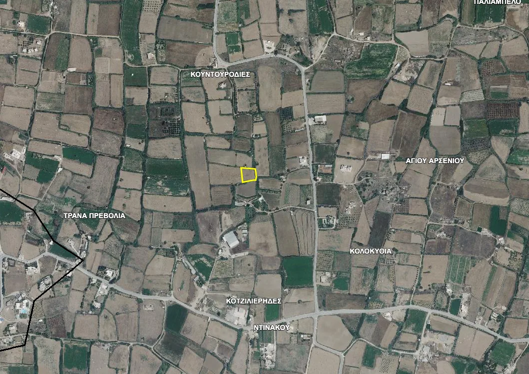
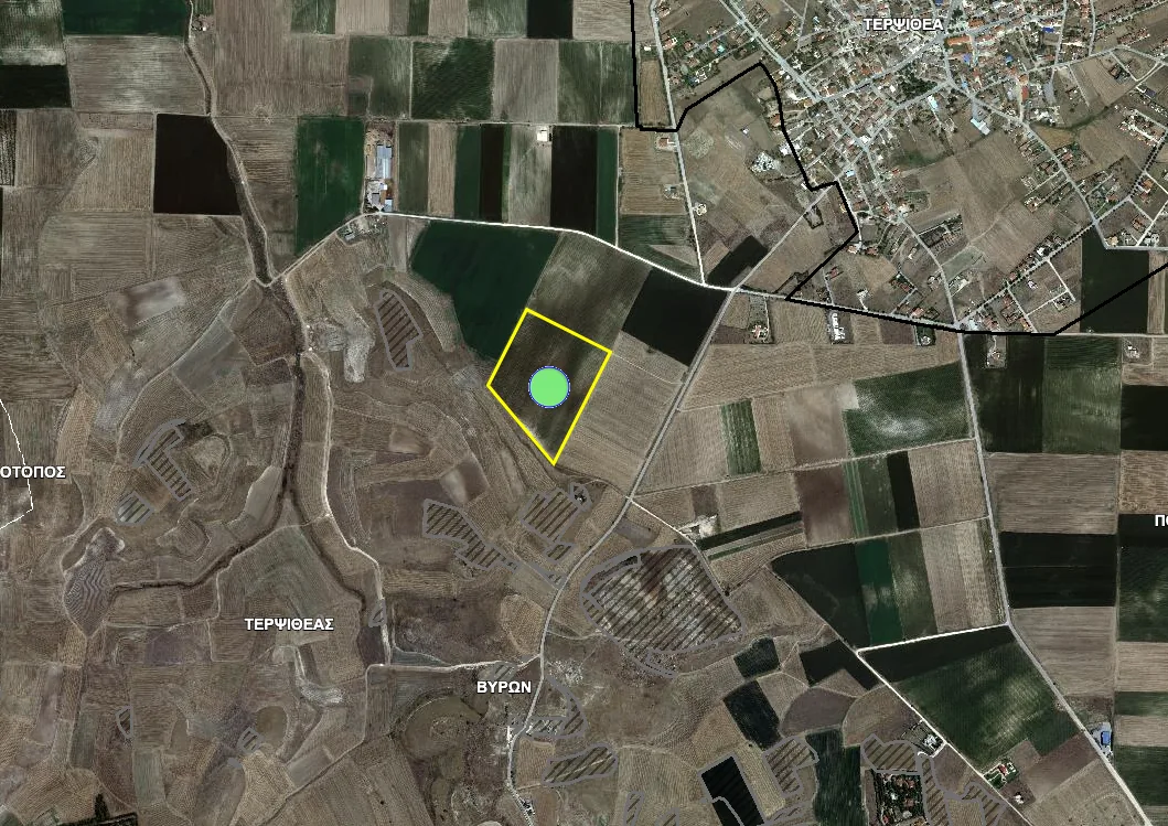
| Τερψιθέα, Larisa 311500507001 56,923 m² | ΑΑ, observation code 1 | Four sampled points agreeing, and an εποικισμός boundary that tells you which archive holds the title history. This plot fails on access instead. |
| Άγιος Αρσένιος, Naxos 290021001061 1,242 m² | ΠΑ | A characterisation act settled it. The strongest clean answer available. |
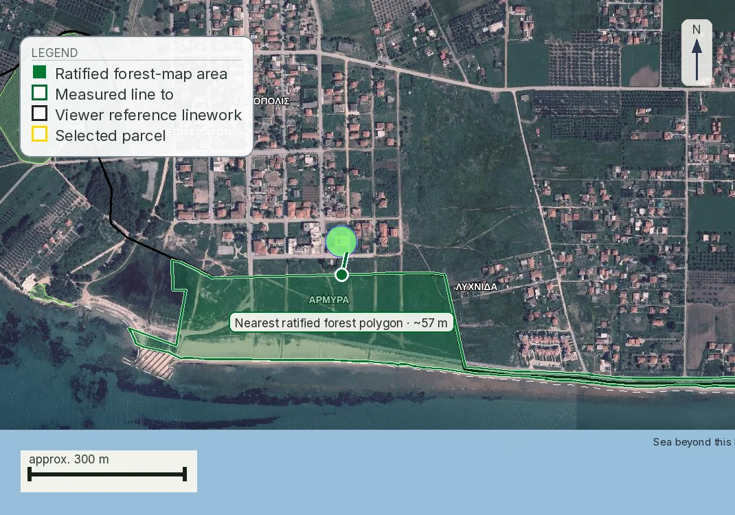
| Νέα Προποντίδα, Halkidiki 490450120002 601 m² | No map posted | Not a clean result. Ask the Διεύθυνση Δασών in writing which of the two causes applies; only one has a πράξη χαρακτηρισμού at the end of it. |
What the notary and the ΥΔΟΜ do with the code
Two other people in the transaction reach the map before you do.
The notary preparing the transfer deed has duties around the character of the property being conveyed, and where the land carries a forest character the deed has to reflect it. The usual failure runs through a notary doing the job correctly: the deed describes exactly what is being sold, in Greek, in a document the buyer does not read closely, and signs.
The ΥΔΟΜ, the local planning authority, reaches the map when a building permit is applied for. That is usually months after the money has moved, which is why the map belongs at the start of the process. A refusal at that stage is rarely converted into a permit on appeal, because the ΥΔΟΜ is applying a code that was already published when you bought. The refusal is still an executable administrative act, and the administrative route comes before the courts: a διοικητική προσφυγή against an act or omission of a ΥΔΟΜ in the permit procedure goes to the regional ΠΕ.ΣΥ.ΠΟ.Θ.Α., filed at the ΥΔΟΜ that issued the decision, within an exclusive thirty days of notification or full knowledge, with a 50 € παράβολο. The provision was άρθρο 23 ν. 4495/2017 (ΦΕΚ Α΄ 167) and is now άρθρο 459 παρ. 5–7 ν. 5306/2026 (ΦΕΚ Α΄ 88/8.6.2026), word for word. The substantive remedy normally attacks the classification. The refusal is a separate case with its own deadline before a different body.
The order that avoids this: read the map, get the extract, agree a price, pay a deposit. Reading the map costs nothing and takes four minutes; the deposit is the first money you cannot get back.
The claims sellers make, and what each is worth
| What you will hear | What it is actually worth |
|---|---|
| "It has been farmed for generations." | Worth nothing against the 1945 reading on its own, and a great deal as documentary evidence inside an objection: receipts, ΟΣΔΕ declarations, earlier titles, old aerial frames. |
| "The neighbour built, so you can too." | The neighbour's plot has its own polygon, and it may carry a different code, an older permit or an unlawful building. Click it on the same viewer. |
| "The objection is already filed." | Ask when, against which polygon and by whom, then have a δασολόγος read the file. Until it succeeds the posted code is what the ΥΔΟΜ applies. |
Costs and timelines, honestly
Checking the viewer yourself is free. An απόσπασμα δασικού χάρτη is a small administrative charge and takes days. An objection carries a state fee, the ειδικό τέλος αντίρρησης below, with the δασολόγος's file on top of it. A πράξη χαρακτηρισμού in an unposted area is the δασολόγος's fee plus the service's own processing, in months.
| Area in dispute | State fee |
|---|---|
| up to 100 m² | 5 € |
| 100–1,000 m² (up to 1 στρέμμα) | 20 € |
| 1,000–5,000 m² (1–5 στρέμματα) | 45 € |
| 5,000–10,000 m² (5–10 στρέμματα) | 90 € |
| 10,000–20,000 m² (10–20 στρέμματα) | 175 € |
| 20,000–100,000 m² (20–100 στρέμματα) | 350 € |
| 100,000–300,000 m² (100–300 στρέμματα) | 700 € |
| over 300,000 m² (over 300 στρέμματα) | 1,650 € |
Scale set by ΚΥΑ 151585/323/2017 (ΦΕΚ Β΄ 347/8.2.2017) and halved by ΥΠΕΝ/ΔΔΕΥ/74394/2692/2021 (ΦΕΚ Β΄ 3589/4.8.2021); the figures above are the reduced ones in force, checked against both instruments on 1 August 2026. The bands are ours in one unit: the ΚΥΑ writes the first two in τετραγωνικά μέτρα and the rest in στρέμματα, at 1,000 m² to the στρέμμα, so exactly 1,000 m² sits at the top of the 20 € band and not in the 45 € one. A quote on the older scale of 10, 40, 90, 180, 350, 700, 1,400 and 3,300 € is a pre-2021 quote, double at every band. The fee is the state's charge only; the δασολόγος bills separately.
Some objections carry no fee at all, and this is the part sellers rarely mention. The exemption is not in the statute: άρθρο 22 παρ. 2 ν. 3889/2010, as replaced by άρθρο 153 παρ. Ι ν. 4389/2016, tells the joint ministerial decision to fix both the scale and «οι περιπτώσεις εξαίρεσης από την υποχρέωση καταβολής», and the list is άρθρο 1 παρ. Β ΚΥΑ 151585/323/2017. There are five cases:
- ground that reached the map only because the ΥΔΟΜ's plan or settlement outline under άρθρο 23 παρ. 2 περ. α΄ ν. 3889/2010 was never plotted on it, and cases under άρθρο 31 παρ. 3β ν. 4280/2014;
- ground that reads as forest on the older photography but sits inside an εποικισμός distribution. These are κληροτεμάχια from the agrarian resettlement, not a village boundary.
- ground that reads as grassland, rocky or stony on either photography and sits inside an εποικισμός area;
- ground carrying a final πράξη χαρακτηρισμού under άρθρο 14 ν. 998/1979 that the posted map does not show;
- the part of an objection that concerns an application still pending under άρθρο 14.
Three of the five depend on the εποικισμός archive. That is why the observation code matters: a 1 beside the characterisation is the map telling you the parcel sits εντός ορίων εποικισμού. Check the exemption before anyone quotes you for a full objection file. Get the quote from a δασολόγος in the same prefecture as the land, and ask how long that Διεύθυνση Δασών is currently taking: backlogs run from months to years and they are local.
What a forest flag does to the price
A flagged plot still has value; what changes is what you are buying. A ΔΔ plot can be held and passed on, and used within the limits the forest law sets for existing lawful use. What it cannot be is a building plot, so the discount that compensates for that is not 20%. It is the gap between the value of building land and the value of forest land in that area, which in most of Greece is most of the price.
Three cases can justify further work on a flagged plot: an outstanding objection with documents behind it; a prior characterisation act the map failed to incorporate, which is a correction rather than an objection; and a flag covering only part of the area, where the clear part is independently viable, which is a survey question before it is a legal one. They are not a closed list, and a δασολόγος reading your file may find a fourth. What they have in common is paper.
The forest map and the cadastre are two different registers
This trips up almost every foreign buyer, because both are run through the same organisation and the same website. The cadastre (Κτηματολόγιο) records boundaries and who owns what. The forest map records what the land legally is. Each has its own procedure, its own objection deadline and its own service, so a clean cadastre entry says nothing at all about forest character.
The practical consequence is that a KAEK boundary and a forest polygon are drawn by different processes and do not align. A forest polygon can cover part of a parcel, cross it diagonally, or stop just short of it. This is why clicking several points matters, and the question to put to a surveyor is what proportion of the parcel's area falls inside the polygon and where the line crosses the boundary. Our own report answers it the same way: the parcel geometry comes from the cadastre, the character from the forest map, and the page draws both outlines on one frame so the overlap can be measured off it.
What happens if you buy anyway
People do, usually because the price looked like an opportunity, and the endings are few. Most often you own the land, the permit is refused, and the money sits in an asset with a much smaller market than the one you thought you were entering; the next buyer runs the same check and finds a documented code, so the realistic exit is a forest-land price. Building without a permit is the one route with no way back. An αυθαίρετο on forest land cannot be regularised at all: άρθρο 89 παρ. 2 περ. στ΄ ν. 4495/2017 (ΦΕΚ Α΄ 167), «Απαγόρευση υπαγωγής», excludes anything «σε δάσος, σε δασική ή αναδασωτέα έκταση», and the same words are now άρθρο 374 παρ. 2 περ. στ΄ ν. 5306/2026 (ΦΕΚ Α΄ 88/8.6.2026), the Κώδικας Χωροταξίας και Πολεοδομίας, which carries the provision over unchanged. The same paragraph bars transferring the property while the unauthorised work stands, so it also closes the exit. An objection can still succeed years later, and for an owner with the documents that is a real strategy, but objections have run for years in several prefectures, and nobody should plan on living there meanwhile.
The paper that settles it, and who to ask
- Απόσπασμα δασικού χάρτη, the extract showing the character code, issued by the Διεύθυνση Δασών. The application prints an unofficial one free; the issued one is what a ΥΔΟΜ works from. Ask that office for the current παράβολο and issue time. Do not rely on a figure from another source, including this page.
- Πράξη χαρακτηρισμού, where one exists: obtain the act itself. A reference to it is not enough.
- Δασολόγος, the forester who runs this work. The objection file, the characterisation application and the technical argument are all theirs; a civil engineer covers the building side instead.
- Your own lawyer, independent of the seller, who reads the extract against the title.
Ask the seller for all of it before you pay a deposit.
What the law requires at the notary, and which document it names
Once a forest map is ratified over the area, άρθρο 20 ν. 3889/2010, «Συνέπειες κύρωσης», governs the transfer itself, and the sanction is severe. Where the parcel is shown as δασική εν γένει έκταση, a transfer is «άκυρη και ανίσχυρη» (void) unless a πιστοποιητικό from the Διεύθυνση Δασών is attached to the deed and recited in it. Without it the Κτηματολογικό Γραφείο will not register the transfer either. The πιστοποιητικό and the απόσπασμα are two different papers from two different desks, and asking for the wrong one costs a signing date.
Where the map shows the parcel as not forest, the certificate is replaced by a υπεύθυνη δήλωση from the engineer, made on the topographic diagram, or, where no topographic diagram is required, on an extract of the forest map. That is the one place the απόσπασμα is named in the statute: as the sheet the declaration is written on. It is not the notary's document.
Keep one limit in view: άρθρο 20 bites on a ratified map. Where the map is merely posted and your objection has been accepted, what goes to the notary is a copy of that decision. Establish which of the three situations you are in before the appointment is booked, because each wants a different piece of paper from a different office.
Common questions
My plot is farmed and has olive trees. Can it still be forest on the map?
Yes, and this is the most common surprise. The map's first reading is the 1945 aerial photograph. Land that was forest then is presumed forest land now, whatever has been cleared or planted since. Clearing forest generally created an offence rather than changing the legal character.
What does ΔΑ mean and is it the worst code?
ΔΑ means forest in 1945 and another form at the second reading, so the ground was cleared at some point between them. ΔΔ weighs more and αναδασωτέα more still, but ΔΑ is the most contested code, because the map and the visible ground disagree. Whether an objection has a chance turns on documents, and on whether an observation code such as 28 records loss of forest character before 11 June 1975.
Where do I see if land is αναδασωτέα?
Not in the Χαρακτηρισμός έκτασης line. The click response returns it separately, as the token ΑΝ in the field Επιπλέον Πληροφορία, beside an ordinary two-letter code. Read only the character line and you will miss it entirely.
The viewer says «Η περιοχή είναι εκτός ανάρτησης». Is that good news?
No, it is an absence of an answer, with two quite different causes. Either the area is genuinely unposted, and the route to certainty is a πράξη χαρακτηρισμού from the Δασαρχείο, or the ground is excluded from the map because it lies inside an approved plan or a delimited settlement, and there is no characterisation to obtain. Ask the Διεύθυνση Δασών in writing which of the two you are in before spending anything.
Is ΧΧ the same as ΑΑ, both non-forest?
No. ΑΑ leaves the land unrestricted by the forest map; ΧΧ stays within the forest service's remit under Ν. 998/1979. What is permitted then depends on observation codes such as 29 for private grassland and 30 for lowland grassland, and on the 100 m / 8% / 12% test in Π.Δ. 32/2016.
How much does a forest flag cut the price?
It is the wrong frame. A ΔΔ plot is not building land, so the comparison is not a percentage off a building-plot price but the value of forest land in that area, which in most of Greece is a small fraction of it. Ask what the land is worth as what it legally is.
Which professional handles this: my engineer, or someone else?
A δασολόγος, a forester. The characterisation application, the objection file and the technical argument are their work. A civil engineer handles the building side and is not a substitute here.
Keep reading
Check this on your own parcel
Pin the plot, confirm the KAEK, and every check in this guide is read against it and written up with its source and date. EUR 39 total · VAT included.