
Pillar: Ground, hazard and utilities
Διαβάστε το άρθρο στα ελληνικά.
Burnt land in Greece: αναδασωτέα, forest maps and the buyer’s next step
On this page
The Trikeri parcel is ΔΔ inside a ratified forest polygon. Fire does not erase that character: find the ΑΝ field, the declaration, any lifting act and the clearing duty before you value the land.
This guide is a preliminary screen for a purchase or permit question, not legal, surveying, engineering or tax advice; read the full scope and limits before relying on it.
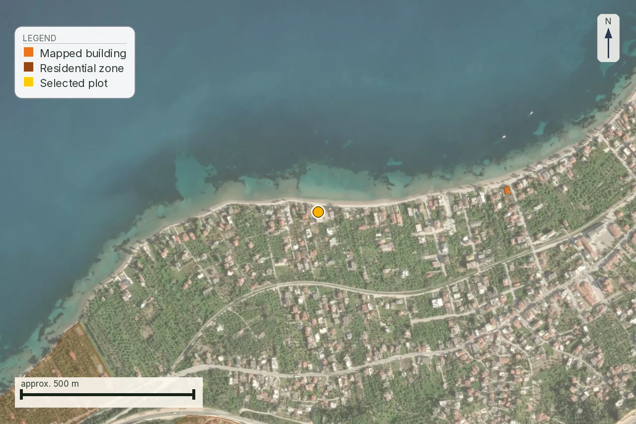
The parcel is 4,905 m² on the Trikeri peninsula in Magnesia, KAEK 350770709141. The live forest-map check on 1 August 2026 returned ΔΔ, with the whole parcel inside a ratified forest polygon at 0 m. Its mean slope is 19.6%. The ground can look like an olive plot or scrub. That appearance is exactly why the fire question belongs beside the forest-map result. For a buyer, the two records must be read together.
Keep the forest-map guide beside the buyer’s purchase checklist while reading this page. The first explains the code and its stage; this page follows the fire, reforestation and clearing files that sit beside it.
For a buyer, “it burned twenty years ago and is scrub now” is a warning to find the declaration, the separate ΑΝ field and any lifting act. Fire does not turn forest land into ordinary development land. The map, the act and the physical maintenance duty answer different parts of the file.
The legal character survives the flames
Article 117 paragraph 3 of the Constitution says that public or private forests and forest land destroyed by fire, or stripped in another way, do not lose the character they had before destruction. They are compulsorily declared for reforestation and cannot be given another destination. The rule is about the land’s legal character, not about whether green growth has returned.
The practical consequence is simple. A listing photograph of black soil, grass or young shrubs does not answer whether the parcel was forest before the fire, whether a declaration followed, or whether a later act lifted it. A buyer must ask for the operative paper and the map evidence. Standing on the plot is not a substitute for that file.
That is why this parcel is a useful example even though the supplied finding is ΔΔ rather than an asserted fire scar. The parcel is forest in both aerial readings and sits in the ratified polygon. If a seller explains away the result by pointing to today’s olive trees or scrub, the seller is describing vegetation. The forest map is answering a different legal question.
What the declaration adds to a ΔΔ result
Article 38 paragraph 1 of Ν. 998/1979, ΦΕΚ Α΄ 289/29.12.1979 makes reforestation mandatory for burnt forest and forest land. Article 41 is the declaratory act issued by the Αποκεντρωμένη Διοίκηση. The distinction matters: article 38 supplies the obligation, while article 41 is the decision a buyer has to locate in the parcel file.
The constitutional rule and the statute do not say that a fire cleans the land of its forest character. They move the land into a restoration regime. The declaration is not a suggestion from a local official and not a planning label the seller can remove by grading the surface. It is a public act with a polygon and a date.
Article 46 lists what may still be sited on reforestation land: defence works, roads and networks, mining works and similar interventions recorded in the provision. A house is not a route on that list. The article does not turn every permitted intervention into a buyer’s right; it records a closed statutory list that must be read with the competent file.
Where the flag hides in the viewer
The forest viewer returns an ordinary two-letter character in the line Χαρακτηρισμός έκτασης. The separate reforestation or afforestation status appears in Επιπλέον Πληροφορία as the token ΑΝ, sometimes followed by an observation code such as ΑΝ,2. This is the finding the forest-map research corrected on 1 August 2026.
A parser that searches only for the two letters in the character line will miss ΑΝ. Widening the character pattern to accept a third letter would not solve it, because ΑΝ lives in another field. The two questions must remain separate on the page and in the buyer’s request to the service.
The published legend calls ΑΝ «ΑΝΑΔΑΣΩΤΕΕΣ Ή ΔΑΣΩΤΕΕΣ ΕΚΤΑΣΕΙΣ». That wording is wider than “burnt land”. A status can concern land declared for afforestation as well as land restored after fire. Therefore ΑΝ is a serious restriction signal and a reason to obtain the act; it is not, by itself, proof of the date or cause of a fire.
For this parcel, the dated live finding is ΔΔ at 0 m inside a ratified polygon. The article does not invent an ΑΝ result for it. It tells the buyer to click and read the additional field because the character code cannot answer that question.
Άρση is an act, not the return of shrubs
Article 44 of Ν. 998/1979 sets the route. It permits lifting where the forest has actually regenerated, or where the land is public, was never forest and cannot be reforested after five years. The decision is based on the reasoned opinion of the Δασάρχης. The route is narrow and tied to facts the buyer cannot establish from a listing.
“The hillside is green again” is not a lifting decision. “The seller’s forester says it will be fine” is not a lifting decision. Ask for the written act, its polygon, its date and the relationship between that polygon and the current cadastral boundary. If the file contains only a promise to apply later, price the land under the current status.
The order of the documents is important. First identify whether there is an ΑΝ field or a reforestation declaration. Then ask whether an άρση exists and exactly what it lifts. Only after that should the engineer test the building and access questions against the remaining forest character. A planning conversation cannot repair a missing forestry act.
The forest map tells a different story from the fire-history layer
The forest map compares older aerial photography with a later reference set. ΔΔ means forest in both readings. It is not a burn-history register. The fire-history evidence here comes from EFFIS, the Copernicus emergency service and European Commission JRC snapshot for Greece.
The EFFIS snapshot contains 1,658 Greek polygons and covers seasons from 2016 to 27 July 2026. It mainly maps fires above roughly 30 hectares. Many standing reforestation declarations follow fires from well before that window, among them the 2007 fires in Ilia and the 2009 fires in Attica, so a negative EFFIS result cannot establish that a plot never burned.
This distinction protects the parcel from two opposite errors. A recent burn polygon would show a mapped fire footprint, not automatically an ΑΝ declaration. No recent polygon would show only that this EFFIS layer has no mapped event there. The legal character comes from the forest record and declaration acts; the recent burn layer is contextual evidence with a stated blind spot.
What the clearing duty does, and what it does not
The annual clearing duty is separate from the reforestation declaration. Ν. 5281/2026, ΦΕΚ Α΄ 28/25.2.2026, article 43 inserted article 53ΙΔ into Ν. 4662/2020. The research records a clearing window from 1 April to 15 June, checks from 16 June to 31 October, and a fine of EUR 1 per square metre of the plot, with a minimum of EUR 200 and a maximum of EUR 2,000, plus the municipality’s own clearing cost.
The duty runs with the land and becomes the new owner’s from the day of signature. Declarations go through akatharista.apps.gov.gr. The older EUR 0.50 per square metre rate and 30 April date belong to the superseded regime under article 266 of Ν. 5037/2023. They should not be used to price this parcel in 2026.
Clearing the plot under the current fire-prevention duty does not give permission to clear forest land, does not change ΔΔ, and does not remove ΑΝ. The owner must ask the municipality what duty applies to the exact space and ask the forestry service what work is lawful under the land’s character.
The sentence that costs the buyer the purchase
“It burned twenty years ago, it is scrub now” contains three unproved jumps. It assumes the fire date. It assumes the present scrub tells us the legal character. It assumes no reforestation act remains. None follows from the sentence.
The correct response is documentary. Ask for the fire date and source. Ask the Διεύθυνση Δασών or the competent forestry office for the reforestation decision and the mapped polygon. Ask whether an άρση has been issued. Ask for the current forest-map extract and read both Χαρακτηρισμός έκτασης and Επιπλέον Πληροφορία. Ask the surveyor to overlay the act’s boundary on the current parcel.
If the seller offers a clearing declaration, keep it in its proper place. It may show that an owner has a current prevention obligation. It does not prove that the land is non-forest or that an ΑΝ status was lifted. If the seller offers only photographs, the file remains open.
One finding and several questions
On 1 August 2026 the live viewer read the parcel as ΔΔ, with the entire 4,905 m² inside a ratified forest polygon at 0 m. Its mean slope is 19.6%. That is the dated finding. The research does not say that it carries ΑΝ, because the supplied observation is the ΔΔ character result and no separate additional-information response is established here.
The honest next step is to request the complete forest response and the official extract. A buyer should not infer “no ΑΝ” from the absence of the token in a shortened report excerpt. Equally, a buyer should not infer “ΑΝ” merely because the seller mentions an old fire. Each status needs its own evidence.
| Question | Evidence to request |
|---|---|
| What is the forest character? | Current forest-map extract showing ΔΔ and the ratified stage. |
| Was land declared for reforestation? | Viewer response with Επιπλέον Πληροφορία and the κήρυξη act. |
| Was the status lifted? | The written άρση decision, polygon and date. |
| What may be cleared? | Municipal prevention instruction plus forestry-service answer tied to the parcel. |
This is why a ΔΔ result is not a minor note in a fire article. It tells the engineer and lawyer that the land’s forest character must be resolved before a house, road, fence or investment value is discussed.
What the Greek buyer can do at the service counter
A Greek buyer who is able to visit the service should take the KAEK, the current topographic diagram, the title chain and any old fire or reforestation paper to the Διεύθυνση Δασών and the local Δασαρχείο. Ask the first office for the map stage and extract, and the local service for individual acts, the declaration file and any lifting route. The two offices do different jobs; sending the map question to the wrong desk wastes time.
Keep the request parcel-specific. Name the municipality, KAEK, area and the polygon shown on the map. Ask for a protocol number when the service receives a written request. If the answer is that an old act cannot be found, record that as missing evidence. Do not rewrite it as “clear”. A foreign buyer can hand this same Greek request to an independent lawyer or forestry professional, with the translated report beside it.
The professional route is a δασολόγος for the character, declaration and lifting file, a surveyor for the overlay and parcel identity, an engineer for any proposed work, and a lawyer for ownership and transaction consequences. One professional’s opinion does not replace the others. This parcel needs all three questions kept on the same geometry.
Before the deposit: a fire-and-forest gate
- Save the dated ΔΔ result and the ratified polygon shown at 0 m.
- Read the entire viewer response, including Επιπλέον Πληροφορία, rather than the character line alone.
- Obtain the number and polygon of any κήρυξη αναδασωτέας.
- Obtain and read any άρση; regrowth, scrub and age are not substitutes.
- Separate EFFIS burn history from the forest-law file and write its coverage limitation beside any negative result.
- Ask the municipality and forestry service what the 2026 clearing duty covers, and put the written answer in the purchase file.
Here, this gate should happen before a buyer pays for a house design or accepts the seller’s valuation of 4,905 m² as a building plot. A forest polygon at 0 m belongs at the start of the file, before the contract. It is the fact around which the rest of the diligence has to be organized.
| Record | Safe reading | Wrong shortcut |
|---|---|---|
| ΔΔ | Forest in the historical and later reference readings. | The current scrub proves the land is ordinary. |
| ΑΝ | Separate reforestation or afforestation information. | It is just another character-code letter. |
| EFFIS absent | No mapped event in that layer’s time and size coverage. | The parcel never burned. |
Three records, three owners of the question
The forest-map viewer gives the map observation. The forestry service gives the individual act. The municipality gives the practical clearing instruction. A buyer can lose weeks by asking one office to answer for all three. Put the same KAEK and the same current boundary at the top of every request, then keep the replies together.
Scope of this page
This is a property preflight, not a legal opinion, forestry certification, survey, building-permit decision or fire-safety approval. It explains what the dated ΔΔ finding for this parcel establishes, where ΑΝ appears, why fire preserves forest character, what article 44 says about lifting and what the current clearing duty adds. It does not assert that the parcel burned, carries ΑΝ, qualifies for άρση or may be built on. Those answers belong to the operative acts and the professionals who read them.
What the map does not confirm
The parcel's ΔΔ result does not confirm a fire date, an ΑΝ declaration, an άρση decision or permission to clear and build. It identifies the document trail that must be read next, with the same parcel boundary on every paper.
Common questions
If the land burned years ago, is it still forest land?
A fire does not remove the forest character the land had before it burned. The constitutional rule and Law 998/1979 require the reforestation question to be checked through its acts, not through today’s vegetation.
Where does the Greek forest viewer show αναδασωτέα?
Read Επιπλέον Πληροφορία as well as Χαρακτηρισμός έκτασης. The separate ΑΝ token can appear beside an ordinary code such as ΔΔ; it is not a third letter inside the character code.
Does ΑΝ prove that this plot was burned?
No. The published class covers αναδασωτέες or δασωτέες land. It can concern restoration after destruction or afforestation, so obtain the declaration and its cause.
Can a bare or scrub-covered hillside be released from reforestation?
Not by appearance. Article 44 records narrow routes based on actual regeneration or, for public land that was never forest, infeasibility after five years. Ask for the written lifting decision.
What may be built on land declared for reforestation?
Article 46 lists limited interventions such as defence works, roads, networks and mining works. A house is not a route named in that list. The competent file must be read for any proposed work.
Does no EFFIS burn polygon mean my Greek parcel never burned?
No. The research snapshot begins in 2016 and mainly maps fires above roughly 30 hectares. Older fire history and standing declarations need separate forestry records.
Who confirms what I may clear on a parcel like this?
The municipality can explain the current annual prevention duty, while the forestry service must address the legal forest character and any reforestation status. Clearing duty is not permission to clear forest land.
When does the clearing obligation become mine after purchase?
The research records that the duty runs with the land and becomes the new owner’s from the day of signature, with the 1 April to 15 June clearing window and later checks.
Keep reading
The Greek forest map (δασικός χάρτης): codes, αναδασωτέα and how to check a plot yourself
Buying forest-flagged land in Greece: ΔΑ, ΑΔ, ΔΔ, objections and αναδασωτέα
Greek flood zones: what a ΖΔΥΚΠ result means for a property buyer
Buying land in Greece: the pre-purchase checklist, in the order the payments fall
Check this on your own parcel
Pin the plot, confirm the KAEK, and every check in this guide is read against it and written up with its source and date. EUR 39 total · VAT included.