
Διαβάστε το άρθρο στα ελληνικά.
Everything that can stop you building in Greece: the restriction stack
On this page
Fourteen separate restrictions decide whether a Greek plot can carry a house. Nine offices keep thirteen of them and nobody keeps the fourteenth. Which end a purchase, which only change the price, who can lift each one, what stage each register is at, and the order to check them in.
This guide is a preliminary screen for a purchase or permit question, not legal, surveying, engineering or tax advice; read the full scope and limits before relying on it.
A buyer who has read one article about Greek land usually knows one restriction. They check the forest map, it comes back clean, and they treat the question as answered. It is not. No Greek statute enumerates what can stop a house, so nobody can hand you a closed list. What follows is ours: fourteen restrictions we have found reaching a residential plot in practice, each tied to the instrument it rests on. Any one of them can refuse on its own, and a clean answer from one says nothing about the next.
This article is the map of that stack: the provision behind each restriction, the office that can lift it, and the stage that office has reached.
Two tests, and the second one holds thirteen checks
Greek practice separates αρτιότητα from οικοδομησιμότητα, which is why so many buyers get a true answer to a question they did not ask. Αρτιότητα is geometry: area, frontage length and depth against a threshold, 4,000 m² out of plan, and it is what «είναι άρτιο» in a listing means. Οικοδομησιμότητα asks whether, once every applicable restriction is applied, a building may stand here. A plot can be άρτιο and not οικοδομήσιμο; the reverse does not happen. Both terms, with the tier table and the transitional deadline, are in the article on άρτιο and οικοδομήσιμο.
The master matrix
Read the third column first. Everything else on the row is procedure.
| Restriction | Legal source | Absolute or conditional | Who can lift it | Where it becomes visible |
|---|---|---|---|---|
| Planning regime, minimum area | Out of plan: ν. 4759/2020 (ΦΕΚ Α´ 245), now άρθρα 251 and 273 ν. 5306/2026 (ΦΕΚ Α´ 88). In a settlement: π.δ. της 24.4.1985 (ΦΕΚ Δ´ 181) άρθρο 5, now άρθρα 226–248 of the same code. | Conditional. A threshold, met or not met. | Nobody. A merger of adjoining plots can pass it. | Βεβαίωση όρων δόμησης from the ΥΔΟΜ, under άρθρο 324 παρ. 2 περ. β ν. 5306/2026. |
| Πρόσωπο (frontage) | The figure: άρθρο 251 παρ. 1 περ. α´ ν. 5306/2026, 4,000 m² and 25 m of frontage onto a κοινόχρηστος δρόμος. What makes a road public: ν. 3155/1955 (ΦΕΚ Α´ 63/14.3.1955) άρθρα 1, 4, not absorbed by the code. Which roads qualify: ΣτΕ Ολομ. 176/2023, still unpublished, the formula written out in ΣτΕ 665/2018 and ΣτΕ 848/2018. | Absolute out of plan, whatever the area. The bar is statutory; the case law settles only which roads count. | Nobody. The road’s public character is established on documents. | Nowhere. No office keeps a list of roads that are κοινόχρηστες in law; you get a written ΥΔΟΜ answer on your engineer’s application or nothing. |
| Forest character | ν. 998/1979 (ΦΕΚ Α´ 289); the map, its objection window and its effects under άρθρα 15, 17, 19 and 20 ν. 3889/2010. | Absolute where the map shows δασική εν γένει έκταση. | Διεύθυνση Δασών, on αντίρρηση in the posted window or πρόδηλο σφάλμα after it. | The forest-map viewer, then the απόσπασμα δασικού χάρτη. |
| Αναδασωτέα | άρθρο 117 παρ. 3 of the Constitution; declaration άρθρο 41 ν. 998/1979, lifting άρθρο 44, the acting official now the Γενικός Γραμματέας Δασών (άρθρο 47 ν. 4915/2022). | Absolute. The land must be restored and cannot be released to another use. | In practice nobody, while the declaration stands. | The Επιπλέον Πληροφορία field returns ΑΝ, outside the two-letter code. |
| Αιγιαλός and παραλία | ν. 5092/2024 (ΦΕΚ Α´ 33/4.3.2024) άρθρα 3, 5 and 6 παρ. 3, whose άρθρο 24 παρ. 1 repealed άρθρα 1–7, 9, 10 and 13 ν. 2971/2001 outright. Άρθρο 8 ν. 2971/2001 is not on that repeal list and survives. | Absolute on the zones. Conditional behind them, through the local terms. | Nobody. The lines are fixed by the committee of άρθρο 5 παρ. 3 ν. 5092/2024, sitting per περιφερειακή ενότητα. | The decision in the ΦΕΚ, and permanently on the Ministry’s website. |
| Ρέμα | ν. 4258/2014 (ΦΕΚ Α´ 94/14.4.2014) άρθρα 3 and 5 παρ. 2 for the lines; the building rule itself is άρθρο 6 of the Κτιριοδομικός Κανονισμός (ΥΠΕΝ/ΔΑΟΚΑ/66006/2360/16.6.2023, ΦΕΚ Β´ 3985/20.6.2023), which άρθρο 244 παρ. 4 ν. 5306/2026 names alongside it. | Conditional, and expressed as a line on the ground: building inside the οριογραμμές is forbidden absolutely, outside them allowed. No national metre setback exists. Άρθρο 225 παρ. 1 ν. 5306/2026, carrying άρθρο 28 παρ. 1 ν. 4067/2012, still leaves those terms to a π.δ. nobody has issued. | Nobody. A temporary delimitation fixes where the line runs. | The οριοθέτηση act, or a 50-year flood line checked by the Περιφέρεια. |
| Archaeology, Zone A | Άρθρο 13 παρ. 2 ν. 4858/2021 (ΦΕΚ Α´ 220/19.11.2021), the antiquities code, at the article number ν. 3028/2002 used; site demarcated under άρθρο 12. Παρ. 1 already puts out-of-plan building anywhere inside the site behind a ministerial permit. | Absolute. A zone in which building is prohibited outright. | Nobody, short of a new ministerial decision. | The designation decision with its diagram, in the ΦΕΚ. |
| Archaeology, Zone B | Άρθρο 13 παρ. 2 ν. 4858/2021, second half: the zone is declared by one decision and its terms fixed by a later joint one. Works near a monument engage άρθρο 10, whose παρ. 6 gives the Ministry three months to answer. | Conditional. Special terms on building, use or activity. | The Ministry of Culture through the local Εφορεία, project by project. | The same ΦΕΚ decision, plus the Εφορεία’s opinion on your design. |
| Natura 2000 | άρθρο 9 ν. 3937/2011 (ΦΕΚ Α´ 60/31.3.2011) for the national Natura framework; άρθρο 10 ν. 4014/2011 (ΦΕΚ Α´ 209), unamended, which files the assessment under άρθρο 11 παρ. 8 for smaller works and παρ. 9–10 for larger. | Conditional. It adds an ecological assessment. | The authority that approves the Ειδική Οικολογική Αξιολόγηση. | The site code on the protected-areas map, and the site’s π.δ. if issued. |
| ΖΟΕ and χρήσεις γης | ΖΟΕ under άρθρο 29 ν. 1337/1983, by π.δ., now άρθρο 274 ν. 5306/2026; use categories under π.δ. 59/2018 (ΦΕΚ Α´ 114/29.6.2018), restated at άρθρα 284 onwards of the same code. | Either. The zone’s own text decides which. | Only a new decree or plan. It is not an individual permission. | The ΖΟΕ decree in the ΦΕΚ; e-Πολεοδομία for an indication. |
| Road building lines | π.δ. 209/1998 (ΦΕΚ Α´ 169/15.7.1998) άρθρο 2 παρ. 1 out of plan and παρ. 2 inside settlements; παρ. 7, added by άρθρο 13 παρ. 18 ν. 3212/2003, lets an approved πολεοδομική μελέτη set a different distance. Not carried into ν. 5306/2026, so a pre-2026 citation here is current. | Conditional. It moves the building back, sometimes off the plot. | Nobody. Where out-of-plan rules give a greater distance, that one applies. | Measured on the topographic diagram; the class comes from the road authority. |
| Expropriation | ν. 2882/2001 (ΦΕΚ Α´ 17/6.2.2001), the Code of Compulsory Expropriations, with the lapse deadlines in άρθρο 11 παρ. 2, unamended since 2001, and παρ. 3, replaced by άρθρο 39 παρ. 3α ν. 4024/2011 and last amended by άρθρο 18 ν. 4949/2022. | Absolute over the strip taken, while the declaration stands. | The authority that declared it; and άρθρο 11 lifts an uncompleted one by operation of law. | The declaring act in the ΦΕΚ with its diagram, and the cadastral record. |
| Border areas | ν. 1892/1990 (ΦΕΚ Α´ 101/31.7.1990) άρθρα 24–26, as replaced by άρθρο 114 ν. 3978/2011 and corrected by άρθρο 43 ν. 4278/2014. Since 2011 the ban catches only buyers «με ιθαγένεια ή έδρα εκτός» the EU and EFTA. | Conditional, and only for non-EU/EFTA buyers. It bites on the transaction, not the building rules. | The committee of άρθρο 26 παρ. 1, in the Αποκεντρωμένη Διοίκηση, on application. No deadline in άρθρο 26; the general 50 days of άρθρο 4 ν. 2690/1999 apply. | At the notary, who will not complete without the decision. |
| Extraction zones | Designation: άρθρο 46 παρ. 5 ν. 4512/2018 (ΦΕΚ Α´ 5/17.1.2018), by απόφαση Περιφερειάρχη published in the ΦΕΚ. The building ban: άρθρο 48 παρ. 1 and 2 of the same law. The planning effect: άρθρο 232 παρ. Α´ περ. 11 ν. 5306/2026. | Absolute inside the zone and for at least 1,000 m outside its οριογραμμή: no plan extension and no «ανέγερση οποιουδήποτε κτίσματος». The relaxations in παρ. 2 cover industry, energy and farm buildings. Housing is not among them. | Nobody on application. The designation decision may set a narrower strip under παρ. 3 and 4, on islands, in border areas and around dwindling settlements. | The designation decision in the ΦΕΚ; the distance is applied by the πολεοδομικά όργανα of ν. 4067/2012. |
The restrictions, one at a time
Planning regime: in plan, inside a settlement, out of plan
Nothing else in the stack can be read until this is fixed, because each regime has its own rulebook. In plan, the ρυμοτομικό σχέδιο sets the minimum plot and the building terms directly. Inside a delimited settlement, άρθρο 5 of the π.δ. της 24.4.1985 (ΦΕΚ Δ´ 181) sets no national figure: it gives a range of 300 to 2,000 m², and the binding number inside it is fixed settlement by settlement.
That regime was rewritten in 2025, which is why the 1985 range needs a date attached. A presidential decree of 11/15.4.2025 (ΦΕΚ Δ´ 194) set new criteria for delimiting settlements, and άρθρο 63 ν. 5215/2025 (ΦΕΚ Α´ 116/4.7.2025) created two categories: the Ζώνη Ανάπτυξης Οικισμού for settlements of up to 700 inhabitants and the Περιοχή Ειδικών Χρήσεων for those of 701 to 2,000. Both now sit in the planning code at άρθρα 226 to 248 ν. 5306/2026, with άρθρο 234 on the new categories, άρθρο 237 on αρτιότητα and άρθρο 238 on what may be built. By August 2026 very few settlements had been re-delimited, so the question for the ΥΔΟΜ has two halves: has this one been re-delimited, and if so into which zone.
Out of plan, the derogations that used to rescue smaller plots were closed by ν. 4759/2020 (ΦΕΚ Α´ 245). What survives is transitional and sits in άρθρο 273 ν. 5306/2026 (ΦΕΚ Α´ 88/8.6.2026); the filing deadline has moved five times and stands at 30 June 2027, put there by άρθρο 133 ν. 5317/2026 (ΦΕΚ Α´ 108/10.7.2026). Ask which regime applies before anything else.
Legal frontage (πρόσωπο σε κοινόχρηστη οδό)
Out of plan the requirement carries a figure. Άρθρο 251 παρ. 1 περ. α´ ν. 5306/2026 asks for a plot of at least 4,000 m² and at least 25 m of frontage onto a κοινόχρηστος δρόμος; the same provision excuses the farm and water buildings of άρθρα 252 and 253 where an αγροτικός or δασικός δρόμος serves them, and mountain refuges reached on foot. What it does not do is say which roads qualify. Ν. 3155/1955 (ΦΕΚ Α´ 63/14.3.1955) divides roads into national, provincial and municipal or communal, and άρθρο 4 defines the last class by what it serves and names no act that creates one, which is why there is no register to consult.
The 25 m is what ends an out-of-plan purchase, and it is statutory. The case law settles something narrower: which roads count. ΣτΕ Ολομ. 176/2023, the Patmos case, held that out-of-plan plots are buildable only where they have, among other things, «πρόσωπο σε κοινόχρηστο χώρο (δρόμο) νομίμως υφιστάμενο», and the published summary continues that the space must not have arisen from private will. The Plenary's own text still awaits καθαρογραφή, so we give that second half as the court's holding and not as its words. Two three-judge decisions we did read in full write the formula out: ΣτΕ 665/2018 and ΣτΕ 848/2018 both carry «δομήσιμα είναι τα γήπεδα που έχουν πρόσωπο σε κοινόχρηστο χώρο νομίμως υφιστάμενο, μη προκύψαντα από ιδιωτική βούληση», read on nomosphysis.org.gr, a private reproduction, and not on the Court's own site. That limb catches a strip conceded by a neighbour or a track cut to serve the plot; an easement of passage gets your car in and creates no frontage. The whole of it is worked through in the article on πρόσωπο.
Forest character
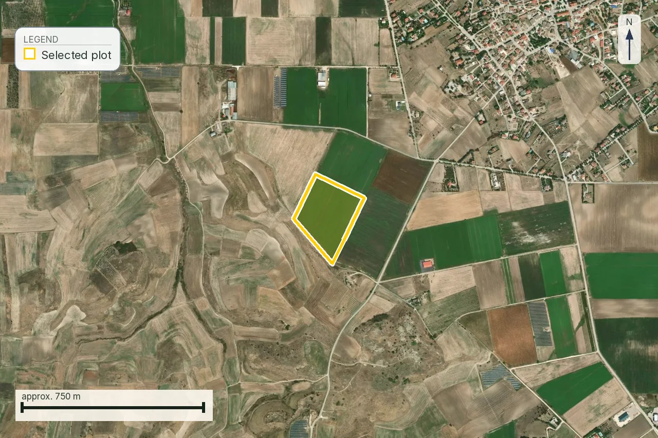
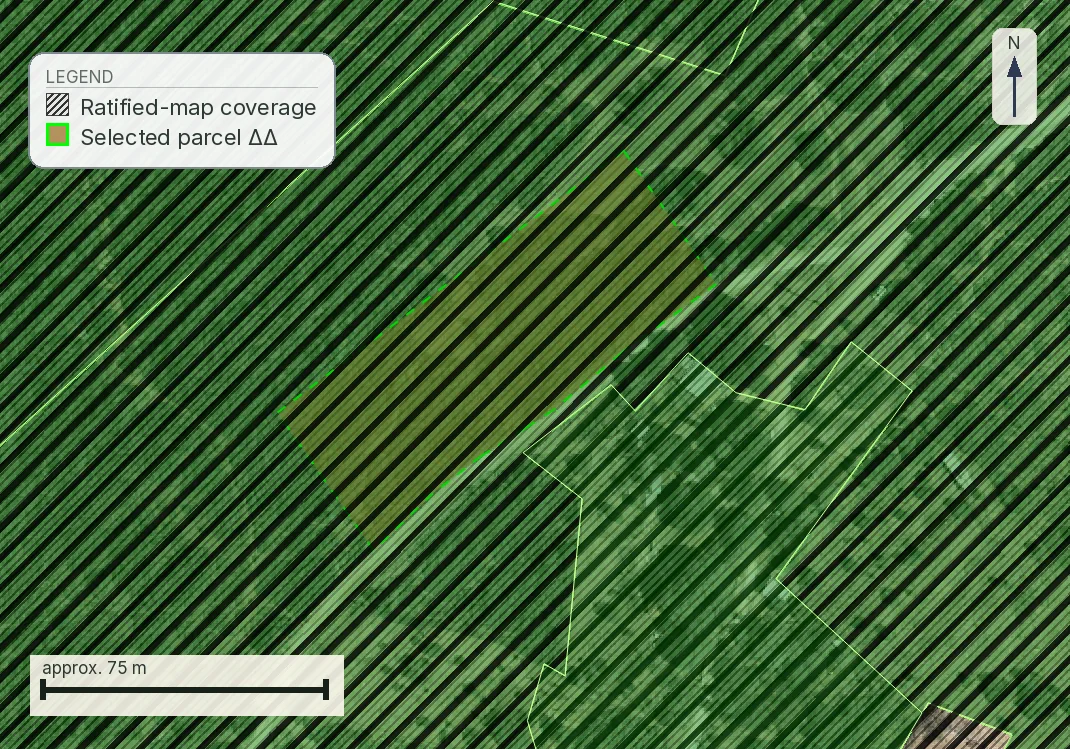
The δασικός χάρτης compares aerial photography from 1945 with a recent series, most often flown in 2007–2009, and returns a two-letter code: the historical reading first, the recent one second. ΔΔ means forest in both and is the strongest form of the finding. Where the map is ratified, άρθρο 20 παρ. 4 ν. 3889/2010 makes a transfer of land shown as δασική εν γένει έκταση «άκυρη και ανίσχυρη» without a certificate from the Διεύθυνση Δασών, so the restriction reaches the sale, not merely the permit. Since άρθρο 213 ν. 5037/2023 that nullity reaches only δικαιοπραξίες εν ζωή, «εξαιρουμένων των δηλώσεων αποδοχής κληρονομίας»: a buyer needs the certificate, an heir does not. Objection windows have closed across most of the country, leaving πρόδηλο σφάλμα or annulment. The detail, including how to probe the viewer yourself, is in the forest-map article.
Reforestation (αναδασωτέα)
This is the restriction most often missed, because it is not where people look for it. It is not one of the character codes. The viewer returns it in a separate field, Επιπλέον Πληροφορία, as the token ΑΝ, and a parcel can carry an ordinary code such as ΔΔ in the character field while that flag sits beside it. Άρθρο 117 παρ. 3 of the Constitution requires burnt forest land to be restored and forbids its release to another use. Declaration runs under άρθρο 41 ν. 998/1979 (ΦΕΚ Α´ 289) and lifting under άρθρο 44; the numbers never moved, but the acting official is now the Γενικός Γραμματέας Δασών, substituted by άρθρο 47 ν. 4915/2022 for the Συντονιστής of the Αποκεντρωμένη Διοίκηση. The published legend titles the class «ΑΝΑΔΑΣΩΤΕΕΣ Ή ΔΑΣΩΤΕΕΣ ΕΚΤΑΣΕΙΣ», so it also covers ground designated for afforestation. A parcel can carry the flag having never burnt.
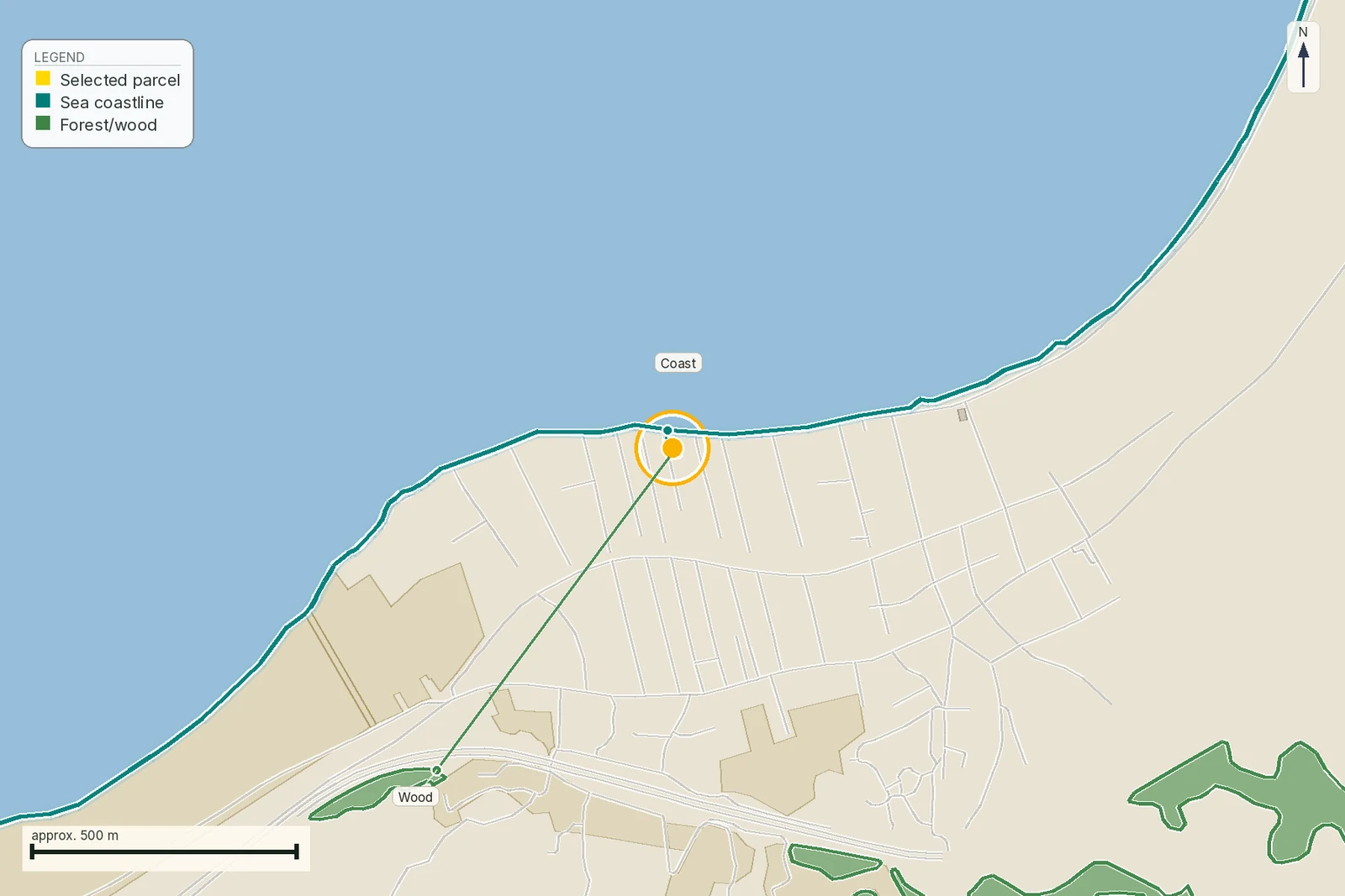
Αιγιαλός and παραλία
There are two lines here, they do different jobs, and the law carrying them was replaced in 2024. Άρθρο 3 ν. 5092/2024 (ΦΕΚ Α´ 33/4.3.2024) defines the αιγιαλός as «η ζώνη ξηράς που βρέχεται από τη θάλασσα κατά τις μεγαλύτερες και συνήθεις αναβάσεις των κυμάτων», and the παραλία as a zone added to it which «δεν μπορεί να εκτείνεται περισσότερο από πενήντα (50) μέτρα από την οριογραμμή του αιγιαλού». Άρθρο 6 παρ. 3 carries the building prohibition on the zones themselves. Those displaced what almost every guide still cites: άρθρο 24 παρ. 1 of the same law repealed άρθρα 1 to 7, 9, 10 and 13 ν. 2971/2001 outright on 4 March 2024. One article of the 2001 law survives and matters to a buyer, άρθρο 8, which makes demarcation a precondition, on pain of nullity, of approving or extending a town plan.
The change to notice is what happens to private rights inside a designated παραλία. The old άρθρο 7 παρ. 2 ν. 2971/2001 expropriated them by force of the publication itself. Άρθρο 5 παρ. 11 ν. 5092/2024 now says only that once the lines are fixed «επιτρέπεται η απαλλοτρίωση, αναγκαστική ή ρυμοτομική, τυχόν ιδιωτικών δικαιωμάτων που προϋπάρχουν». Along long stretches of coast no line has been drawn at all. Our article on the coastal zone covers the buyer’s side of it.
Ρέμα (watercourse)
Whether a channel counts as a ρέμα is a legal question, and a dry bed that runs twice a winter can qualify. Ν. 4258/2014 (ΦΕΚ Α´ 94/14.4.2014) sets the delimitation procedure. Where a stream has no delimited lines and you need a permit near it, άρθρο 5 παρ. 2 opens a temporary route: you commission a hydraulic study of the catchment, the flood lines for a fifty-year return period are drawn on the topographic diagram, and the technical service of the Περιφέρεια endorses them. Building is then permitted outside those lines and outside the banks, at distances that come from ν. 4067/2012 (ΦΕΚ Α´ 79/9.4.2012).
The question everyone asks next is how many metres back the house has to sit. Building beside a stream is governed by άρθρο 6 of the Κτιριοδομικός Κανονισμός (ΥΠΕΝ/ΔΑΟΚΑ/66006/2360/16.6.2023, ΦΕΚ Β´ 3985/20.6.2023), which άρθρο 244 παρ. 4 ν. 5306/2026 names beside ν. 4258/2014 for exactly this purpose, and its rule is a line and not a distance: building «απαγορεύεται απολύτως» inside the ground enclosed by the οριογραμμές, and outside them it is allowed once any διευθέτηση works the delimitation provided for have been built. Παρ. 4 applies that in plan, inside a settlement and out of plan alike. The power to fix «όροι και προϋποθέσεις δόμησης κοντά σε ρέματα» by presidential decree survives unused at άρθρο 225 παρ. 1 ν. 5306/2026.
Your setback is therefore your own delimitation, and the cost of the question sits in the hydraulic study. Where a seller quotes you twenty metres there is a real provision behind the number, and it is a different one. Άρθρο 374 ν. 5306/2026, on which structures may be taken into the αυθαίρετα regime, supplies default lines for streams with neither a delimitation nor a temporary one. For a catchment of up to 1 km² out of plan, or 0.5 km² inside a plan or settlement, those lines are the banks themselves; up to 10 km² out of plan or 5 km² inside, they run 20 m either side of the βαθιά γραμμή; above that, 50 m either side. They apply «αποκλειστικά για την εφαρμογή του παρόντος», which is legalising a building that already stands.
Archaeology: Zone A and Zone B
An archaeological site is declared and demarcated by ministerial decision under άρθρο 12 of the antiquities code, ν. 4858/2021 (ΦΕΚ Α´ 220/19.11.2021), which took ν. 3028/2002 over article by article and kept the numbering; the 2021 number is the live one to quote at an office.
Άρθρο 13 does two things, and buyers usually hear only the second. Παρ. 1 already puts farming, grazing, hunting and building anywhere inside a terrestrial site lying outside a plan or settlement behind a permit, granted by the Minister of Culture on the Council’s opinion. Παρ. 2 then allows zones inside that site: a Ζώνη Προστασίας Α´ in which «απαγορεύεται παντελώς η δόμηση», and a Ζώνη Προστασίας Β´ carrying special regulations on building terms, land uses or permitted activities. Both are declared by ministerial decision published in the ΦΕΚ with a diagram, which is what makes them findable. A Zone B declaration still does not tell you what may be built there: παρ. 2 leaves the terms to a later joint decision of the culture minister and whichever minister is competent for the subject.
What matters commercially is the difference between a formally designated zone, published with a diagram, and the general fact that a region is rich in antiquities, which imposes nothing until an act says so. Works in the vicinity of a monument engage άρθρο 10 separately, and the Εφορεία Αρχαιοτήτων answers on a specific design, so its opinion is outside anything a register search can return in advance.
Natura 2000
Designation is the restriction most often overstated to buyers, usually by someone who wants a discount. It is not a building ban. Άρθρο 9 ν. 3937/2011 (ΦΕΚ Α´ 60/31.3.2011) carries the national framework, and άρθρο 10 ν. 4014/2011 (ΦΕΚ Α´ 209) sets the licensing route for works inside a Natura site: the assessment weighs the consequences for the site against its conservation objectives, delivered as a standalone Ειδική Οικολογική Αξιολόγηση for smaller projects under άρθρο 11 παρ. 8, and inside the environmental impact study for larger ones under παρ. 9 and 10.
What designation adds is an assessment step, and its route depends on the category the ministerial catalogue puts your project in, so ask the engineer that before you assume a timetable. The statutory stages for a category Α2 project, and the absence of any answering deadline for a category Β one, are in the table further down. Where a decree has been issued for the particular site, παρ. 1 of άρθρο 10 puts its terms ahead of the general route, and those terms vary between sites far more than the procedure does. We did not establish the παράβολο, so take no fee figure from us or from a seller without the decision that sets it.
ΖΟΕ and χρήσεις γης
A Ζώνη Οικιστικού Ελέγχου is established by presidential decree around the edges of towns and settlements, and the decree sets the zone’s width, the permitted uses and the minimum area below which the land may not be subdivided; a subdivision made against it is void. Because each ΖΟΕ is its own decree, no general statement about ΖΟΕ land is worth anything: one zone raises the minimum plot to ten στρέμματα, the next forbids residential use in a sub-zone and allows it in the next.
Both instruments behind this row changed their number on 8 June 2026 without changing their content. Άρθρο 29 ν. 1337/1983 was repealed by άρθρο 477 and Παράρτημα Α´ ν. 5306/2026 and re-enacted, paragraph for paragraph, as άρθρο 274; the proposing minister is now Περιβάλλοντος και Ενέργειας and the body consulted is ΣΥ.ΠΟ.Θ.Α./ΚΕ.ΣΥ.ΠΟ.Θ.Α. Π.δ. 59/2018 (ΦΕΚ Α´ 114/29.6.2018), «Κατηγορίες και περιεχόμενο χρήσεων γης», went the same way and is now άρθρα 284 to 304, one article per general category. Άρθρο 304 παρ. 3 keeps the older split: uses set by a Γ.Π.Σ. or Σ.Χ.Ο.Ο.Α.Π. approved before 29 June 2018 «εξακολουθούν να ισχύουν όπως καθορίστηκαν», under π.δ. 81/1980 or π.δ. 23.2/6.3.1987, while anything approved or revised since follows the code. Existing ΖΟΕ keep full effect until a Τοπικό Πολεοδομικό Σχέδιο absorbs the ground. Read the decree for the actual zone, and check whether a newer plan has replaced it.
Building lines along classified roads
A plot with a good road along its frontage can still be unbuildable because of that road, and the figures sit in one instrument in two paragraphs. Άρθρο 2 παρ. 1 of π.δ. 209/1998 (ΦΕΚ Α´ 169/15.7.1998) governs outside approved plans: 60 m from the axis and not less than 40 m from the boundary on the basic national network, 45 m and not less than 30 m on the secondary national, 30 m from the axis on the tertiary national, 20 m on the primary provincial and 15 m on the secondary provincial. Παρ. 2 governs inside settlements, where those drop to 30 m from the axis and not less than 20 m from the boundary on the basic national network, 15 m on the secondary national, and 10 m on both the tertiary national and the primary provincial. Παρ. 1(θ) adds the override: where the out-of-plan rules give a greater distance, that one applies. Distances run from the axis unless the text says «από το όριο».
Those figures are π.δ. 209/1998 as enacted, and the decree usually cited beside it did not touch them: π.δ. 221/1999 (ΦΕΚ Α´ 188/20.9.1999) replaced παρ. 1 of άρθρο 3, which extends the άρθρο 2 distances to new road works, and left άρθρο 2 as it stood. What did reach άρθρο 2 is άρθρο 13 παρ. 18 ν. 3212/2003 (ΦΕΚ Α´ 308/31.12.2003), adding a παρ. 7 under which the distances «μπορεί να είναι διαφορετικές σύμφωνα με πολεοδομικές μελέτες» in listed situations, including extension of a plan inside a ΓΠΣ or ΣΧΟΟΑΠ and inclusion in a plan inside settlements of up to 2,000 inhabitants or pre-1923 ones. A smaller setback read off an approved local study is therefore not automatically an illegality. Παρ. 6 carries an islands carve-out that does not apply to Crete, Euboea, Rhodes or Corfu.
The class is the whole answer, so do the arithmetic once on a real plot. Our Τρίκερι parcel is 4,905 m². The same mapped road reaches its boundary: the parcel-edge-to-road-line measurement is 0.4 m, printed as 1 m in the report after its floor. The 28 m stored for this report was measured from the order point inside the parcel to the road; it is not a plot-to-road distance and must not be used for setback arithmetic. Out of plan the building must also stand 15 m clear of every boundary under άρθρο 251 παρ. 4 περ. α´ ν. 5306/2026. If the road is τριτεύον εθνικό, the line is 30 m from the road axis. If it is δευτερεύον εθνικό, the governing line is 45 m from the axis and never less than 30 m from the road boundary. If it is δευτερεύον επαρχιακό, the line is 15 m from the axis. Because the road reaches the parcel, all three classifications can affect the roadside part of this plot; the exact line needs the surveyed axis and boundary. Only the road authority can confirm the class in writing.
Expropriation
A declared compulsory expropriation takes the ground itself, and it is written down where you can go and read it. Ν. 2882/2001 (ΦΕΚ Α´ 17/6.2.2001), the Κώδικας Αναγκαστικών Απαλλοτριώσεων Ακινήτων, governs the procedure, and the declaring decision is published with a cadastral diagram showing the strip taken and the properties inside it. A declaration that was never completed can be lifted, which is a live question with old road and utility schemes, so the age of the act matters as much as its existence. And an in-plan plot burdened by a ρυμοτομική απαλλοτρίωση the municipality never completed is a different animal from a plot the state is actively taking; your lawyer should say which one you are looking at before you price it.
The lapse deadlines are where the law moved, and the two rules have opposite histories. Άρθρο 11 παρ. 2 has stood unamended since 2001, and it does not apply to expropriations for town plans, housing development or archaeological purposes, which is one reason a ρυμοτομική burden behaves differently. Άρθρο 11 παρ. 3, the automatic lapse, was replaced by άρθρο 39 παρ. 3α ν. 4024/2011 and amended again by άρθρο 18 ν. 4949/2022, which moved the certifying act from four months to six and cut the owner’s window to keep the expropriation alive from a year to six months. Anyone still quoting four months is reading a text superseded in July 2022.
Border and restricted areas
In the παραμεθόριες περιοχές listed in άρθρο 24 ν. 1892/1990 (ΦΕΚ Α´ 101/31.7.1990), άρθρο 25 prohibits transactions over real property and άρθρο 26 lets the prohibition be lifted on application. Read the current text and not the 1990 one, because the 2011 rewrite changed who is caught: άρθρο 114 ν. 3978/2011 replaced άρθρο 24 outright and rewrote παρ. 1 of άρθρο 25, which now bites only on natural or legal persons «με ιθαγένεια ή έδρα εκτός των κρατών-μελών της Ευρωπαϊκής Ένωσης και της Ευρωπαϊκής Ζώνης Ελευθέρων Συναλλαγών». An EU or EFTA buyer is outside it altogether; everyone else applies to the committee of άρθρο 26 παρ. 1 in the Αποκεντρωμένη Διοίκηση, which decides by majority and needs the Ministry of National Defence representative's vote among those in favour. Παρ. 2 no longer carries a separate third-country route; the 2011 replacement left it as a transitional rule for applications already filed. The listed areas changed too, most recently by άρθρο 43 παρ. 1 ν. 4278/2014, which added Οθωνοί, Μαθράκι and Ερείκουσσα.
This restriction is different in kind from the rest of the stack: it leaves the building rules untouched and goes to whether the deed can be signed at all, which is why it surfaces at the notary. Άρθρο 26 gives the committee no deadline, so what applies is the general 50 days of άρθρο 4 παρ. 1 ν. 2690/1999, which start only once the file is complete and carry no deemed approval. Our article on border zones covers the application.
Extraction zones
Λατομικές περιοχές are designated by decision of the Περιφερειάρχης under άρθρο 46 παρ. 5 ν. 4512/2018 (ΦΕΚ Α´ 5/17.1.2018), published in the ΦΕΚ on the binding opinion of the committee of άρθρο 47; in Attica the siting belongs to the Minister. Mineral rights are a separate estate from surface ownership, which is why a quarry can open near land whose owner was never consulted.
A designated zone is usually described to buyers as a nuisance question. It is a legal one, and the provision is άρθρο 48. Παρ. 1 has two limbs pointing in opposite directions. The first keeps the zone at least 1,000 m away from approved town plans, approved residential extensions and the approved boundaries of pre-1923 settlements. The second runs the other way: «Μέσα στις λατομικές περιοχές, καθώς και σε απόσταση τουλάχιστον χιλίων μέτρων έξω από την οριογραμμή τους απαγορεύεται η επέκταση του σχεδίου πόλεως ή η δημιουργία ανεξάρτητου ρυμοτομικού σχεδίου ή η ανέγερση οποιουδήποτε κτίσματος», excepting only buildings tied to the quarrying itself. Παρ. 2 puts enforcement on «τα οικεία πολεοδομικά όργανα του ν. 4067/2012», the bodies that issue permits, and relaxes the distance to 500 m for industrial and energy installations and for farm buildings, stores and greenhouses, to 150 m for wind pylons and to 100 m for photovoltaic arrays. A dwelling is on none of those lists, so for a house the 1,000 m stands.
Three things follow. The trigger is a designated λατομική περιοχή: a licensed λατομείο outside one carries no exclusion of its own. The strip can lawfully be narrower where παρ. 3 or παρ. 4 let the designation decision shrink it, on islands, in border areas and around dwindling settlements, so the ΦΕΚ decision governs and not a buffer you draw yourself. And the distances in άρθρο 85 of the Κανονισμός Μεταλλευτικών και Λατομικών Εργασιών (ΥΑ Δ7/Α/οικ.12050/2223/2011, ΦΕΚ Β´ 1227/14.6.2011) run one way only: they oblige the quarry to keep 250 m from dwellings, doubled where explosives are used, and 50 m from roads. They give nobody a ground to refuse a permit for a new house.
The designation reaches the planning map as well. Άρθρο 232 παρ. Α´ ν. 5306/2026 lists the ground that must stay outside a settlement boundary when one is delimited or re-delimited, and περ. 11 puts λατομικές εκτάσεις αδρανών υλικών on it, beside forest land, reforestation land and Zone A archaeology. Ask the Περιφέρεια whether a designation exists and where its οριογραμμή runs, because that answer decides whether you are a kilometre clear of it or inside the ban.
When two of them land on the same plot
Restrictions overlap, and an overlap changes what you have to do and who you have to do it with. Three patterns come up often enough to name.
Two authorities, two files, no coordination. A coastal plot inside a Natura site needs the environmental assessment and the coastal position established separately, and neither office will chase the other for you. Your engineer runs both clocks. Where an archaeological zone overlaps either, a third file opens at the Εφορεία.
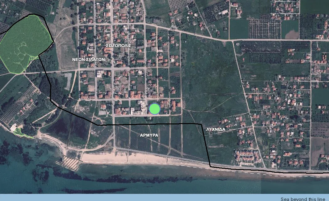
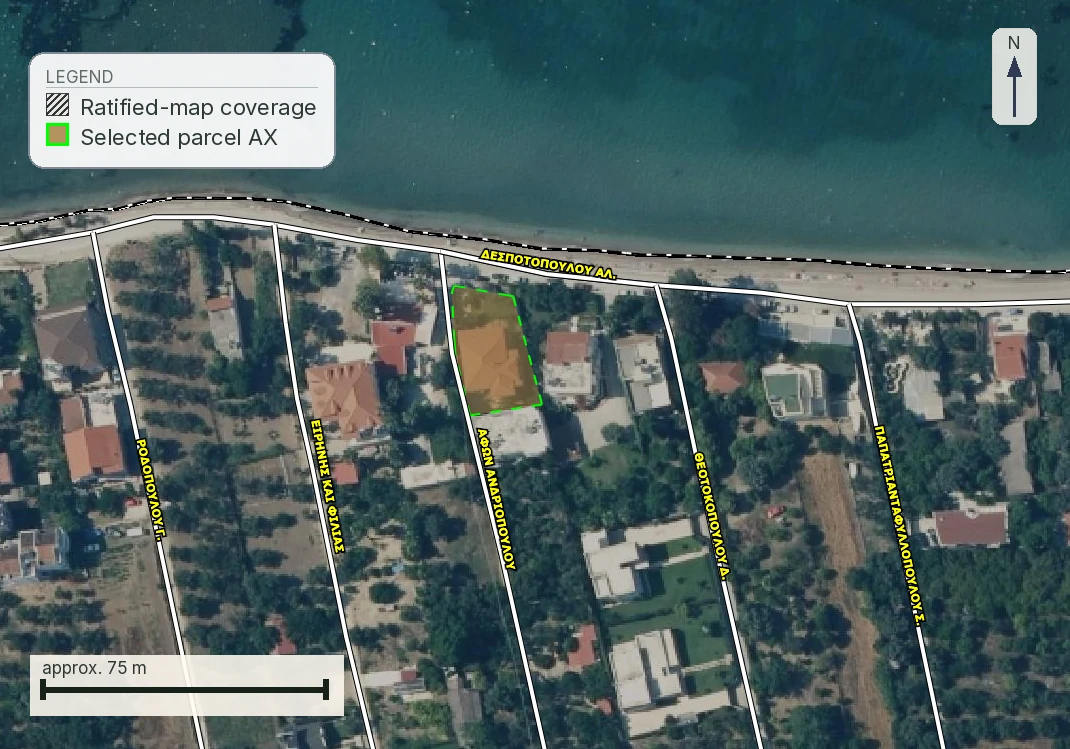
One restriction hides another. Our plot at Νέα Προποντίδα is the case to look at, and each of its three answers comes from a different layer. The forest-map viewer has nothing posted over the parcel. The official αιγιαλός and παραλία linework, which the report reads from the e-Πολεοδομία service, returns no demarcation along that stretch of shore. The report's flood page puts a corridor about sixteen metres away, measured to the nearest mapped watercourse over ground screened as low-lying on the Copernicus elevation model. Two of the three answer with silence. A buyer reading quickly records two clean results and a minor caveat, when the file actually holds one measured hazard and two questions nobody has asked yet.
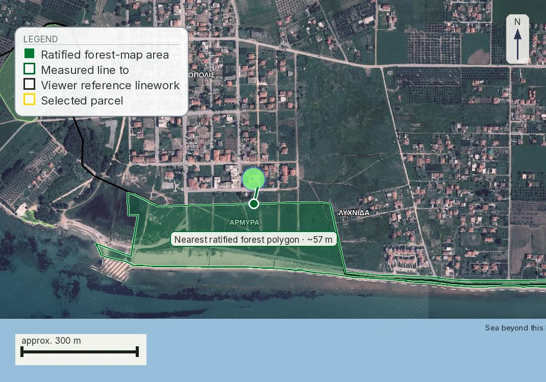
The fatal one makes the rest academic. At Τρίκερι the plot sits inside a ratified forest polygon at zero metres, with the mapped road reaching the boundary. The report also stores a 28 m reading from the order point inside the plot, which is not the plot-to-road distance, and a mean slope of 19.6%. The slope would be a design cost and the road a frontage question worth weeks of work. Neither is worth starting, which is the argument for the order in the next section: the forest map is free and public, and here it retires every other item on the list.
The order to walk it
The stack has an order, and it is not the order a purchase naturally unfolds in. The free checks that can end it go first; the ones that cost money and bind come last.
The deposit belongs on the far side of the frontage answer. Run the process in conversational order, which is agent, viewing, deposit, then engineer, and you will have committed money before the ΥΔΟΜ's written answer on frontage arrives.
One rule covers every step, and buyers break it most often. When a register answers with nothing, write down that it answered with nothing. An unposted forest map, an undrawn αιγιαλός line, a stream with no delimitation act and a ΖΟΕ decree you could not obtain are four open items, each of which can be closed later by an administrative act nobody has to consult you about. A file that records them as blanks is one you can hand to a lawyer. A file that records them as passes will mislead you a second time when you come to sell.
Forest questions divide between two offices. Questions about the map itself, including ratification, posting and objections, belong to the Forest Directorate of the Decentralised Administration. The local Forest Office handles parcel-specific acts, including an application for a characterisation act under άρθρο 14 ν. 998/1979; objections to a posted map are examined by the ΕΠ.Ε.Α.
What stage each register is at, and what clock is running
Knowing who keeps a register is half of it. The other half is the stage that register has reached and whether anything about your plot is still open in it. Sellers describe this loosely, and the loose version usually implies a process is still in motion when it has closed.
| Register | Where it stands, 2 August 2026 | The clock, and the provision that sets it |
|---|---|---|
| Forest map | Ratified over most of the country and public in the viewer. | Objections run in an exclusive window of 105 days from the date set in the πρόσκληση, extended by 20 days for people living abroad: άρθρο 15 ν. 3889/2010 as replaced by άρθρο δεύτερο παρ. 1 ν. 4462/2017. The 45 days still printed by the consolidations is the 2010 figure. The Διεύθυνση Δασών then has two months from the end of the objection hearings to correct and endorse the map (άρθρο 19 παρ. 1, as amended by άρθρο 48 παρ. 6 ν. 4685/2020), and ratification issues within 10 days of the map reaching the signing official, in the ΦΕΚ (άρθρα 17 παρ. 4–5 and 19 παρ. 2). Two routes survive after that: πρόδηλο σφάλμα, with no deadline in the statute and confined to the closed list of ΥΑ 153394/919/2017 (ΦΕΚ Β´ 1366/2017), and an αίτηση ακυρώσεως to the ΣτΕ against the ratification act (άρθρο 19 παρ. 5). |
| Αιγιαλός and παραλία | Drawn in patches. Long stretches of coast have no line. The governing law changed on 4 March 2024. | The old clocks are gone. The 5 days for the Κτηματική Υπηρεσία and the one month for the committee sat in άρθρα 5 παρ. 1 and 5 παρ. 3 ν. 2971/2001, repealed in part by άρθρο 11 παρ. 5 ν. 4281/2014 and then outright by ν. 5092/2024. What runs now: the committee of άρθρο 5 παρ. 3 ν. 5092/2024 sits per περιφερειακή ενότητα, its decision goes in the ΦΕΚ and stays permanently on the Ministry’s website, knowledge is presumed three months after that posting, and an ενδικοφανής προσφυγή to the second-instance committee runs 30 days. We found no provision giving the committee itself an answering deadline. Άρθρο 8 ν. 2971/2001 survives and still makes demarcation a precondition of approving or extending a town plan, on pain of nullity, with six months where a tourist facility is involved. |
| Ρέμα | Most watercourses in the country have no ratified delimitation. | The delimitation file is checked in 30 working days; the water and related services have 45 working days to give opinions and the file proceeds without any that arrive late; the municipal council has one month, with the diagram posted; the act is then ratified by the head of the Αποκεντρωμένη Διοίκηση (the law still says Γενικός Γραμματέας; the office has since been Συντονιστής and then Γραμματέας, and we found no provision cleanly making that substitution for this law) or by the competent minister, and by presidential decree inside an archaeological site or a traditional settlement (άρθρο 3 ν. 4258/2014). Until that happens the temporary route of άρθρο 5 παρ. 2 is what you have. Where a settlement is delimited for the first time over an undelimited stream, the delimitation becomes compulsory within five years of the decree, at the municipality’s expense (άρθρο 244 παρ. 4 ν. 5306/2026). |
| Archaeology | A zone exists only where a decision has been published for it. | Sites are declared and demarcated by decision of the Minister of Culture (άρθρο 12 ν. 4858/2021); zones A and B follow the same route, with a diagram published alongside the decision in the ΦΕΚ (άρθρο 13 παρ. 2). A Zone B declaration does not yet tell you what may be built in it: the terms come from a later joint decision, which παρ. 2 requires within three months of the draft reaching the co-signing ministry. Where άρθρο 10 is engaged, παρ. 6 gives the Ministry three months from the application, and two months for shop licensing. The Εφορεία’s opinion on your design has no separate clock, because it is not sought until a design exists. |
| Natura 2000 | Sites designated nationally; site-specific decrees issued for some of them. | Category Α2 runs to the statutory timetable of άρθρο 4 παρ. 3 ν. 4014/2011, as replaced by άρθρο 2 παρ. 3 ν. 4685/2020: 5 working days for the completeness check, 30 days for consultation and opinions, 20 working days for the evaluation and 10 working days for the ΑΕΠΟ to issue. The ΑΕΠΟ then holds fifteen years and not ten (άρθρο 2 παρ. 8, as replaced by άρθρο 1 παρ. 1 ν. 4685/2020). Those figures are what the law allows each stage, not what a file takes; we opened no provision attaching a consequence to the administration exceeding them, so budget them as a floor. Category Β files its Ειδική Οικολογική Αξιολόγηση with the environment service of the Περιφέρεια under άρθρο 11 παρ. 8, and the law gives that service no answering deadline. |
| Expropriation | Old declarations that were never completed are common on rural land. | Άρθρο 11 παρ. 3 ν. 2882/2001 lifts an expropriation by operation of law where it is not completed within eighteen months of the publication of the decision provisionally fixing compensation. The authority then has six months for the certifying act in the ΦΕΚ, four until άρθρο 18 ν. 4949/2022 (ΦΕΚ Α´ 126/1.7.2022), and owners who want the expropriation kept have six months rather than the earlier year to say so. Παρ. 2 requires revocation where four years pass from the declaration with neither an application to fix compensation nor a settlement, gives the authority four months for the revoking act, bars the application once a year has passed beyond the four, and does not apply to expropriations for town plans, housing development or archaeological purposes. Άρθρο 12 παρ. 2 adds a five-year rule where the beneficiary is a private party. |
| Border areas | The prohibition is in force in the listed areas. | The committee of άρθρο 26 παρ. 1 ν. 1892/1990 decides on application, by majority, and the vote of the Ministry of National Defence representative has to be among those in favour. That committee is the route for every buyer the prohibition reaches. Παρ. 2 is not a second route: άρθρο 114 παρ. 3 ν. 3978/2011 replaced the old third-country procedure with a transitional sentence sending applications already filed to the new text. Παρ. 3, added by άρθρο 13 παρ. 2 ν. 4281/2014, opens a ministerial route for ΤΑΙΠΕΔ privatisation deals and for nothing else. Neither άρθρο 26 nor the ΚΥΑ that lists the documents (Φ.114/497810/2023, ΦΕΚ Β´ 1893/26.3.2024) gives the committee a deadline, so the general 50 days of άρθρο 4 παρ. 1 ν. 2690/1999 apply, counted from the day the file is complete and carrying no deemed approval. That is the practical risk in it. |
| Planning regime, out of plan | The surviving derogations are transitional and dated. | Άρθρο 273 ν. 5306/2026 keeps them alive to a filing date of 30 June 2027, moved there by άρθρο 133 ν. 5317/2026 (ΦΕΚ Α´ 108/10.7.2026). This is the one deadline on this page that a buyer can personally miss. |
| Settlements, ΖΟΕ, frontage, extraction zones | Four registers with no window, no posting and nothing to be late for. | Άρθρα 226–248 ν. 5306/2026 bite on a settlement only once it has its own delimitation decree, with άρθρο 245 for procedures still running on 15 April 2025, and no completion date is set, so the 1985 terms govern until your decree appears. A ΖΟΕ changes only by a new decree or a newer plan over the same ground (άρθρο 274 ν. 5306/2026). Frontage has no register at all, so no posting, no objection window and no act to appeal: you commission a written ΥΔΟΜ answer, or you go without one. A λατομική περιοχή has no window either: the designation is a ΦΕΚ decision of the Περιφερειάρχης that stands until another one replaces it, and the 1,000 m ban of άρθρο 48 παρ. 1 ν. 4512/2018 applies from publication, with nothing to object to and nothing to be late for. The one route back is to challenge the designation act itself before the ΣτΕ within 60 days of publication, on the general rule of άρθρο 46 π.δ. 18/1989. |
Most of the clocks in that table run against an office. Several run against you, and each of them starts only when an act lands on your plot: 30 days for an ενδικοφανής προσφυγή against an αιγιαλός demarcation, 60 days at the ΣτΕ against an extraction-zone designation or a forest-map ratification, six months for an owner who wants an expropriation kept alive after it has lapsed, and the objection window where a forest map is still on display. For most buyers none of those ever starts. One deadline runs for everybody, whatever happens to their plot: out-of-plan derogations close for filing on 30 June 2027. That is the one to put in a diary now.
Where these figures come from, and what did not close
Half the figures in the tables above depend on an amendment chain rather than on the law as enacted, so every chain behind them was walked article by article against the gazette on 2 August 2026. What was read where, and what each row now rests on:
Read in the gazette itself, from the Εθνικό Τυπογραφείο PDFs: ν. 5306/2026 (Α´ 88/8.6.2026), including άρθρα 225, 232, 244, 251, 274, 284–304 and 374 as quoted here, and its amending ν. 5317/2026 (Α´ 108/10.7.2026); ν. 5092/2024 (Α´ 33/4.3.2024); ν. 4685/2020 (Α´ 92/7.5.2020); ν. 4462/2017 (Α´ 38); ν. 4949/2022 (Α´ 126); ν. 5037/2023 (Α´ 78); ν. 4759/2020 (Α´ 245); ν. 4495/2017 (Α´ 167); the settlements decree of 11/15.4.2025 (Δ´ 194); π.δ. 209/1998 (Α´ 169) alongside both instruments that have touched it, π.δ. 221/1999 (Α´ 188) and ν. 3212/2003 (Α´ 308); and the Κτιριοδομικός Κανονισμός (Β´ 3985/20.6.2023).
Traced from the enacted text through every amendment, and quoted here as the chain leaves them: ν. 3889/2010 on forest maps, where the objection window is 105 days and not the 45 the free consolidations still print, the Διεύθυνση Δασών has two months and not thirty days, the ΣτΕ right sits in άρθρο 19 παρ. 5, and the nullity of άρθρο 20 παρ. 4 has reached only deeds between the living since άρθρο 213 ν. 5037/2023; ν. 4014/2011, where the ΑΕΠΟ runs fifteen years and not ten, retroactively for every decision alive on 7 May 2020, and the Α2 timetable sits in παρ. 3; ν. 4512/2018, where the designation power is άρθρο 46 παρ. 5 and the building ban άρθρο 48 παρ. 1 of the same law; ν. 2971/2001, whose άρθρα 1–7, 9, 10 and 13 were repealed outright by άρθρο 24 παρ. 1 ν. 5092/2024, leaving άρθρο 8 standing; ν. 1892/1990, whose άρθρα 24–26 were replaced by άρθρο 114 ν. 3978/2011 and corrected by άρθρο 43 ν. 4278/2014; ν. 2882/2001, where the certifying act of άρθρο 11 παρ. 3 has had six months since άρθρο 18 ν. 4949/2022; ν. 1337/1983 άρθρο 29 and π.δ. 59/2018, both repealed on 8 June 2026 and re-enacted inside the code; and the reforestation procedure of ν. 998/1979 άρθρα 41 and 44, whose numbers never moved but whose acting official is now the Γενικός Γραμματέας Δασών under άρθρο 47 ν. 4915/2022.
Confirmed unamended for the provision relied on, on 2 August 2026: ν. 4258/2014 άρθρο 3 and the three conditions of άρθρο 5 παρ. 2 (both articles were amended in 2020, but not in the figures quoted here); ν. 4014/2011 άρθρα 10 and 11 παρ. 8–10; ν. 3937/2011 άρθρο 9, which is the Natura framework and survived the repeal of άρθρο 8 παρ. 7 by ν. 5299/2026; and ν. 3155/1955 άρθρα 1 and 4, which the 2026 code neither absorbed nor listed for repeal. Archaeology was read in a consolidating instrument, ν. 4858/2021, itself a code carrying ν. 3028/2002 forward.
Three chains did not close, and we are not treating any of them as settled. The Κανονισμός Μεταλλευτικών και Λατομικών Εργασιών is consolidated free only to 23 March 2019, so the quarry setbacks of άρθρο 85 are given as they stood then. Who signs a watercourse delimitation today cannot be stated with certainty: the Γενικός Γραμματέας of the Αποκεντρωμένη Διοίκηση became Συντονιστής by a general substitution and a Γραμματέας now exists alongside him, but the later substitution is an enumerated list that does not name ν. 4258/2014. And ΦΕΚ Α´ 63/1955, which carries the road classes of ν. 3155/1955, is an image-only scan on the gazette’s own store, so that katharevousa wording rests on ΣτΕ 273/2016 and a codification rather than on the printed page.
One warning about the free databases, since this page was built partly against them. E-nomothesia.gr serves stale text under a current-looking consolidation banner: its ν. 4014/2011 is the pre-2020 wording under a header claiming currency to November 2024. Kodiko.gr shows a repeal notice on live laws that is an unrendered template. Nomoskopio.gr carries ν. 2882/2001 άρθρο 11 παρ. 3 in its 2018 state, four months where the law has said six since July 2022. Where a figure here matters to a decision, confirm it against the ΦΕΚ or with the office that keeps the register.
What our report does with the stack, and where it stops
The report walks these registers in the same order and prints what each returns for your KAEK: the planning regime, the forest code with the field the reforestation flag lives in, distance to the nearest ratified forest polygon, the coastal and flood corridors, Natura site membership, archaeology, and the road network with its class. That is a screen: it reaches the registers that publish machine-readable data and not the ones that do not, which include the two that most often decide the outcome, whether a specific road is legally κοινόχρηστη and what a ΖΟΕ decree says for a specific sub-zone.
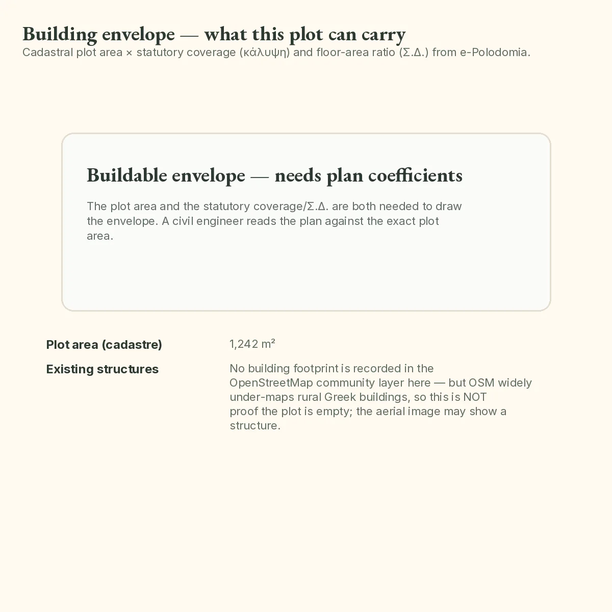
Of our six standing parcels, not one comes through the stack with nothing to declare. Πόρος on Lefkada averages 28.6% slope, ΚΑΕΚ 29002ΕΚ10017 on Naxos sits at sea level with a flood corridor at forty-six metres, and the other four are the ones pictured on this page. Six parcels picked for geographic spread are not a sample of the Greek market, so six out of six is a count and not a prevalence, and we have no prevalence to give you. What the run does show is narrower and worth knowing: on every one of the six the screen returned at least one item that has to be written down and carried into the next step.
What binds, and how far each one reaches
A clean answer from one register is evidence about that register and nothing else, and no single document closes the stack. The βεβαίωση όρων δόμησης from the ΥΔΟΜ, now under άρθρο 324 παρ. 2 περ. β ν. 5306/2026, which codifies άρθρο 38 παρ. 2 ν. 4495/2017 (ΦΕΚ Α´ 167), binds on the planning terms for the plot and stops there. Forest character binds through the ratified map and the certificate of the Διεύθυνση Δασών, the coastal lines through the committee's decision in the ΦΕΚ, archaeology through the designation act and then the Εφορεία's opinion on a design, an expropriation through the declaring act, and who owns the ground through the cadastral record. Six binding answers, six offices, and the βεβαίωση is the planning one. Walking the stack first is how you decide which of them your plot is worth paying for, and in what order.
Common questions
Which restriction stops the most Greek purchases?
Two of them, rarely the ones a buyer worries about. Forest character on a ratified δασικός χάρτης reaches the sale itself: άρθρο 20 ν. 3889/2010 makes a transfer of land shown as δασική εν γένει έκταση invalid without a certificate from the Διεύθυνση Δασών. Lack of πρόσωπο stops an out-of-plan permit however large the plot, because άρθρο 251 παρ. 1 περ. α΄ ν. 5306/2026 asks for 25 m of frontage onto a κοινόχρηστος δρόμος. Both are checkable before you pay anyone.
Does Natura 2000 mean I cannot build?
No. Designation adds an assessment step; it does not prohibit building. Άρθρο 10 ν. 4014/2011 routes works inside a Natura site through an Ειδική Οικολογική Αξιολόγηση focused on the site's conservation objectives, filed on its own for smaller projects and inside the environmental impact study for larger ones. Where a decree exists for the specific site, its terms come first. A category Α2 approval runs to the stages of άρθρο 4 παρ. 3, as replaced in 2020, and the ΑΕΠΟ then holds fifteen years. A category Β project files its ΕΟΑ with the Περιφέρεια, which the law gives no deadline.
The plot is 400 m from the sea. Does the αιγιαλός affect it?
Directly, only if it falls inside the αιγιαλός or the παραλία. Άρθρο 3 ν. 5092/2024, which replaced the repealed άρθρο 1 ν. 2971/2001 on 4 March 2024, caps the παραλία at fifty metres from the αιγιαλός line, so at 400 m the zones themselves are not on your land. What can still reach you at that distance is the local terms: a ΖΟΕ, a use restriction or a coastal setback in the applicable plan. Ask the ΥΔΟΜ for the terms; the Κτηματική Υπηρεσία holds only the demarcation.
No αιγιαλός line has ever been drawn on this stretch of coast. Is that good news?
It means nobody has drawn the line yet, which is a different situation from having drawn it clear of your plot. The lines are fixed by the committee of άρθρο 5 παρ. 3 ν. 5092/2024 and published, and where no decision exists nobody can tell you where the boundary of State property runs. Our launch sample at Νέα Προποντίδα is exactly this case. A demarcation issued later applies to the land as it stands then, whatever the contract said.
There is a dry ditch along the boundary. Does that count as a ρέμα?
It can. Ν. 4258/2014 defines υδατορέματα by function, as the formations that receive surface runoff; whether water is in them on the day you visit does not enter the definition. If the channel has no delimited lines, άρθρο 5 παρ. 2 gives a temporary route: a hydraulic study of the catchment, fifty-year flood lines on the topographic diagram, endorsed by the technical service of the Περιφέρεια. Expect no metre figure at the end. Άρθρο 6 of the Κτιριοδομικός Κανονισμός (ΦΕΚ Β΄ 3985/20.6.2023) forbids building inside the οριογραμμές and allows it outside, and the twenty metres people quote comes from άρθρο 374 ν. 5306/2026, whose default lines apply «αποκλειστικά» to legalising buildings that already stand.
What is the difference between Zone A and Zone B archaeology?
Άρθρο 13 ν. 4858/2021, the antiquities code that carries forward άρθρο 13 ν. 3028/2002, provides for both. Zone A is a zone in which building is prohibited outright; Zone B carries special regulations on building terms, land uses or permitted activities, so it works as an approval step. Both are designated by decision published in the ΦΕΚ with a diagram, which is what makes them findable. A region simply being rich in antiquities is not a zone and imposes nothing until an act says otherwise.
A national road runs past the plot. Is that an advantage?
It helps the access and it costs you envelope. Άρθρο 2 παρ. 1 π.δ. 209/1998 requires buildings outside approved plans to stand 60 m from the axis of a road on the basic national network and not less than 40 m from its boundary, with smaller figures down the classification. Where general out-of-plan rules give a greater distance, the greater governs; παρ. 7, added by άρθρο 13 παρ. 18 ν. 3212/2003, lets an approved πολεοδομική μελέτη set a different distance in the situations it lists. On a shallow roadside plot the setback can leave no buildable area.
Can one document tell me the whole answer?
No. One document binds on the planning side and comes at the end: the βεβαίωση όρων δόμησης from the ΥΔΟΜ under άρθρο 324 παρ. 2 περ. β ν. 5306/2026, codifying άρθρο 38 παρ. 2 ν. 4495/2017. It states the planning terms that apply to the specific plot and settles nothing beyond them; forest character, the coastal lines, archaeology and a declared expropriation each bind through their own act from their own office. It is issued on an engineer's application and takes weeks, so you walk the stack yourself first to decide whether the plot is worth commissioning one for. A broker's note, an old topographic diagram's terms box and a neighbour's permit are indications.
Keep reading
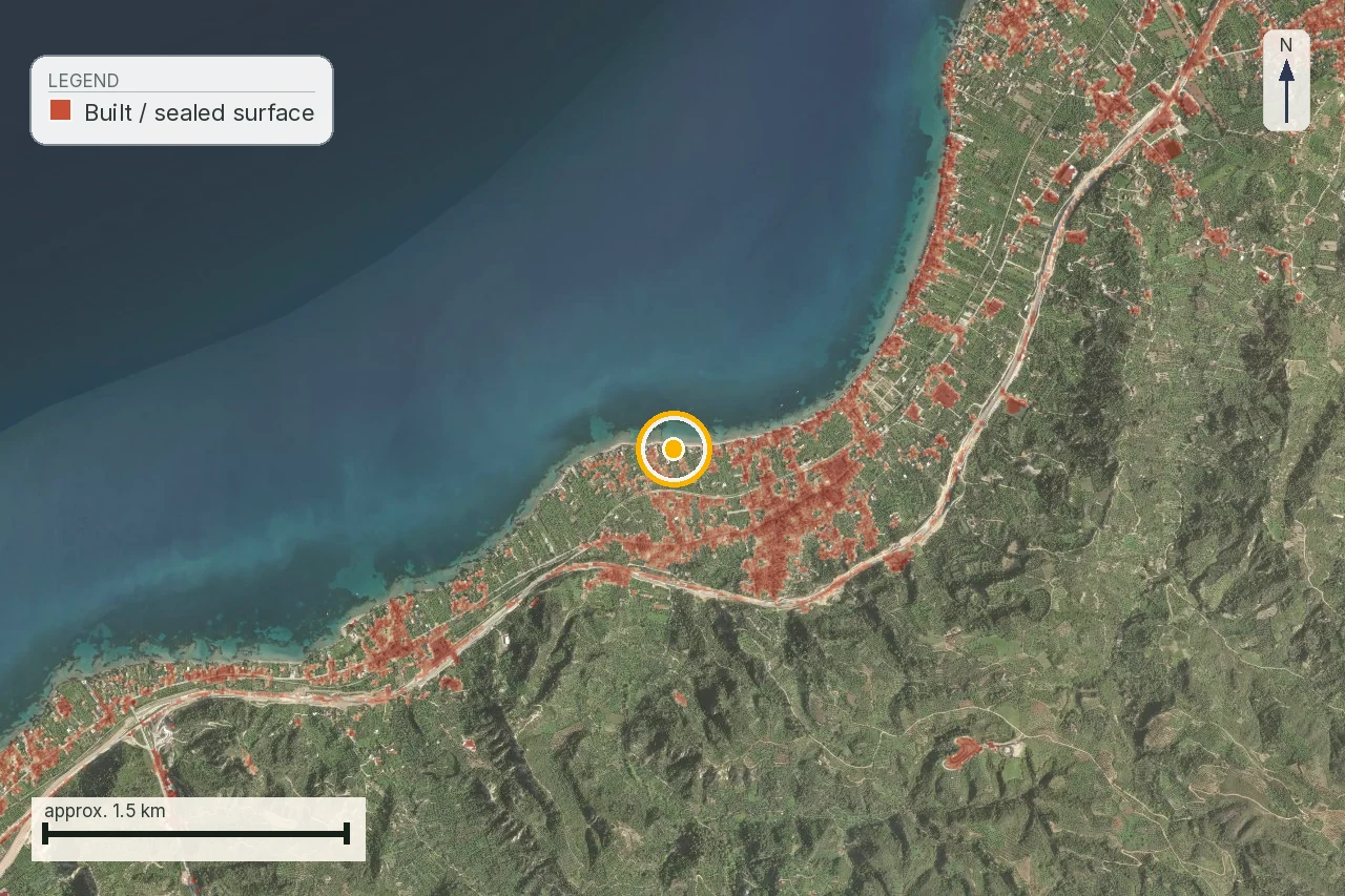
What makes a Greek plot buildable: άρτιο, οικοδομήσιμο and the 4,000 m² rule
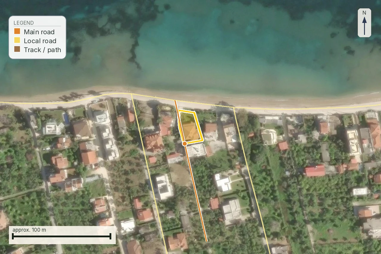
Legal road access in Greece: what πρόσωπο σε κοινόχρηστη οδό means, and how a road becomes public
The Greek forest map (δασικός χάρτης): codes, αναδασωτέα and how to check a plot yourself
Check this on your own parcel
Pin the plot, confirm the KAEK, and every check in this guide is read against it and written up with its source and date. EUR 39 total · VAT included.