
Διαβάστε το άρθρο στα ελληνικά.
Legal road access in Greece: what πρόσωπο σε κοινόχρηστη οδό means, and how a road becomes public
On this page
Why a road one metre away can still leave a plot unbuildable: what κοινόχρηστη οδός means, how a road is recognised, what ΣτΕ Ολομ. 176/2023 closed off, and the difference between an easement and frontage.
This guide is a preliminary screen for a purchase or permit question, not legal, surveying, engineering or tax advice; read the full scope and limits before relying on it.
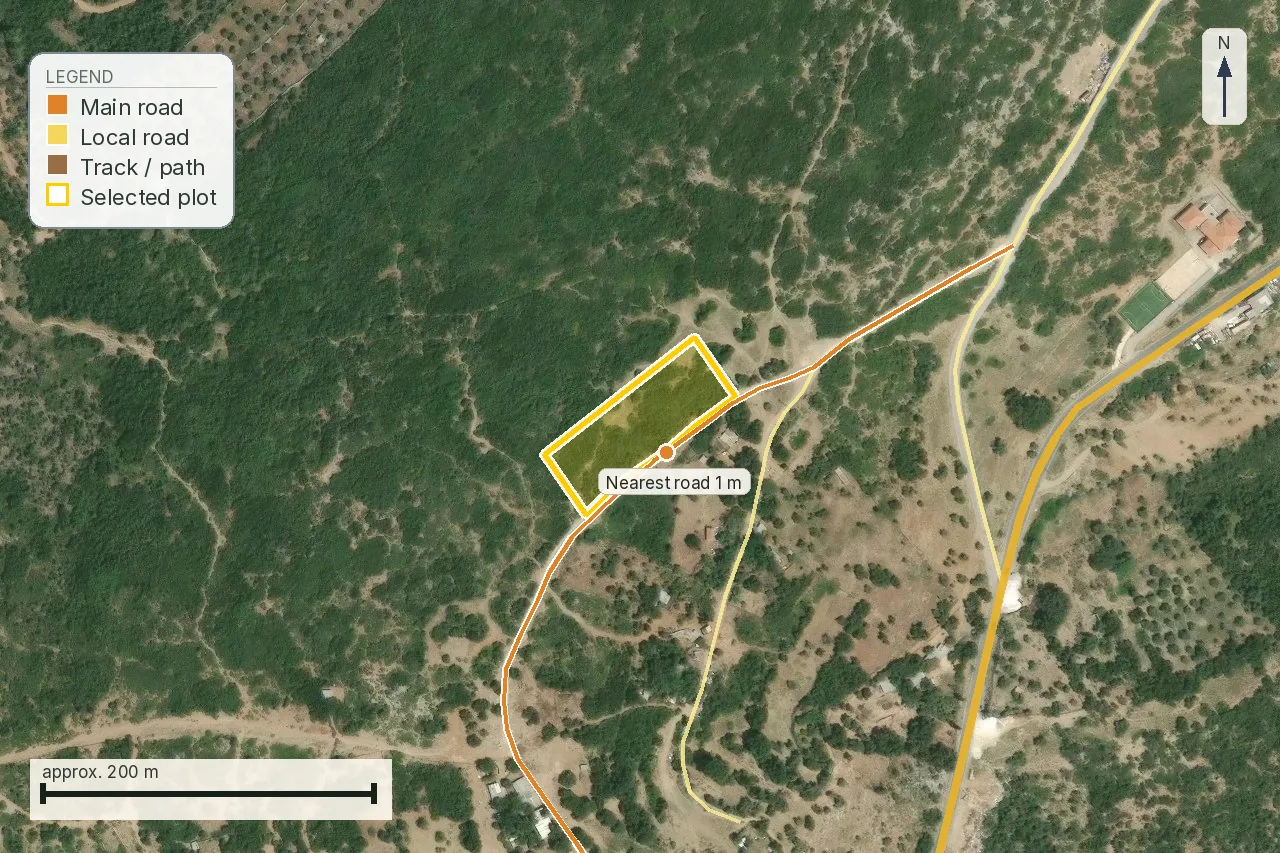
The report we ran on 4,905 m² at Trikeri in Magnesia printed one metre to the nearest road on its access map, along a classified road that runs the length of the plot’s south-east boundary. Our own summary table for the same job printed 28 m. We have since gone back into the files that job stored and settled it: the road touches the plot, the two figures are measured from two different origins, and the section on our report below shows the working. At either number the legal answer is unchanged, because a planning office does not ask how far the road is. It asks whether the road is public in law, and no distance answers that.
The question is πρόσωπο σε κοινόχρηστη οδό, frontage onto a road that is public in law. Without it an out-of-plan plot is not οικοδομήσιμο, however large it is and however good the access looks on the day you visit. The area test can be settled from the deed and a tape measure. The frontage test cannot be settled from any register in the country, which is why on most files it surfaces only once a permit application forces someone to answer it.
Three different things get called “access”
A listing that says «πρόσβαση» can mean any of these, and they are not degrees of the same thing.
- Physical access. You can drive there. It carries no legal consequence at all, and it is what most viewings actually establish.
- Δουλεία διόδου, an easement of passage. A real right over a neighbour’s land, registered against their title. It gets your car in. That is useful, but the plot still has no πρόσωπο, because the strip you cross stays private property.
- Πρόσωπο σε κοινόχρηστη οδό. The plot boundary touches a road that is legally public. This is the one a ΥΔΟΜ tests, and the only one that unlocks a permit out of plan.
Surfacing decides nothing in either direction. A dirt road whose public character is established gives πρόσωπο; a smooth private drive laid last year does not.
There is a fourth thing, and it is what an owner reaches for when the neighbours will not agree. Άρθρα 1012 to 1015 of the Civil Code give the owner of a plot that lacks the necessary way out a claim against them: «Αν ακίνητο στερείται την αναγκαία δίοδο προς το δρόμο, έχει δικαίωμα ο κύριος του να απαιτήσει δίοδο από τους γείτονες έναντι ανάλογης αποζημίωσης» (άρθρο 1012). Under άρθρο 1013 the line the way takes, the extent of the right and the compensation are all fixed by a court rather than by agreement, which makes this litigation. Two limits matter before anyone offers it to you as a solution. Άρθρο 1014 refuses the claim where the connection to the public road was lost through the owner’s own act or omission. Άρθρο 1015 puts the burden on the seller’s remaining land where it was a part-sale that cut the access off, which is the common case on a subdivided family holding. Read what the claim is for: a way to the road. What it produces is a right of passage over private land, so it lands in the same place as a negotiated δουλεία διόδου. It gets a car in and it creates no πρόσωπο.
What the Council of State settled in 2023
The Plenary held in ΣτΕ Ολομ. 176/2023, on a case from Patmos, that minimum area alone does not make an out-of-plan plot buildable. The plot also needs «πρόσωπο σε κοινόχρηστο χώρο (δρόμο) νομίμως υφιστάμενο», frontage onto a public space, a road, that lawfully exists. On the court’s reading the requirement has applied ever since the 1985 out-of-plan decree, so a seller arguing that his plot predates ν. 3212/2003 is arguing about the wrong date.
Now the part most pages skip. The full text of the decision has never been published. Three years on, the court’s own posting still ends «Το πλήρες κείμενο της απόφασης θα αναρτηθεί αμέσως μετά την καθαρογραφή του από το Δικαστήριο». On 1 August 2026 adjustice.gr answered our request with a login redirect and ste.gr timed out. What we did reach that day is the court’s own published summary, reproduced by the environmental-law portal Νόμος και Φύση with adjustice.gr named as its source, and that summary carries the words inside the quotation marks above. It then continues «και μη προκύψαντα από ιδιωτική βούληση», a road not produced by private will. Four legal-press reports of the decision, in Lawspot, Dasarxeio, the ΤΕΕ press and michanikos.gr, stop at «νομίμως υφιστάμενο», which is why the private-will element sits outside the quotation marks above and is given as the court’s holding rather than as its exact words.
The formula is older than the 2023 decision, and we have read it in two judgments whose text we could open. ΣτΕ 665/2018 and ΣτΕ 848/2018 both carry it: «δομήσιμα είναι τα γήπεδα που έχουν πρόσωπο σε κοινόχρηστο χώρο νομίμως υφιστάμενο, μη προκύψαντα από ιδιωτική βούληση». Be exact about how far that gets us. We read both at nomosphysis.org.gr, the archive of the Εταιρεία Δικαίου Περιβάλλοντος, which reproduces each decision with its Περίληψη and its Βασικές Σκέψεις; neither was opened from the Court’s own publication. Both are three-judge chamber decisions applying the 1985 decree. What they establish is that the sentence is standing wording and that it predates 2023. They do not tell you what the Plenary reasoned, and that is the part still missing: the σκεπτικό of 176/2023 is unpublished, so the private-will half of the 2023 holding rests on the court’s own summary and on two chambers having written the same sentence before it.
The reasoning is structural. If owners could manufacture their own access, scattered settlement would spread outside any plan, which is what out-of-plan control exists to prevent. The line is older than the decision, running back through ΣτΕ 2606/2005 and 3848–9/2005. The same summary records that the court upheld the rule against άρθρο 17 of the Constitution and Article 1 of Protocol 1 ECHR and rejected an argument from legitimate expectations. That last part matters because it is the reply most buyers reach for. The appellant had bought in 2015, with permits issued in 2006 and 2011 already on the plot, and argued that the frontage requirement was judge-made and unforeseeable. The court answered that the rule was applied expressly in ΣΕ 2606 and 3848–9/2005, before those permits, and spelled out further in ΣΕ 3504/2010 (seven-judge), so it was foreseeable to a diligent buyer and ought in any case to have been known to the planning authorities. Buying in good faith on someone else’s permit is not an answer to it.
Two consequences follow directly, and both are common in practice.
- A παραχώρηση by a neighbour, a strip conceded for access however formally documented, does not create a road that gives πρόσωπο.
- A newly opened track, cut to serve the plot, does not either. Solid, gravelled and gated makes no difference to how it is treated.
How a road becomes public in the first place
The statute that classifies Greek roads is ν. 3155/1955 (ΦΕΚ Α´ 63/14.3.1955). Άρθρο 1 divides them into national, provincial and municipal or communal. Άρθρο 4 defines the last class by what it serves: «Δημοτικαί και Κοινοτικαί οδοί είναι αι οδοί αι εξυπηρετούσαι τας πάσης φύσεως ανάγκας ενός Δήμου ή μιας Κοινότητος εντός των διοικητικών ορίων αύτού».
Read what that provision is doing. It defines a class by function. It does not name a decision of a δημοτικό συμβούλιο as the act that makes a road municipal, and it sets up no recognition procedure. That reading is not ours alone. ΣτΕ 273/2016 sets the same three articles out in order, describes άρθρα 2 and 3 as fixing «την έννοια και την διαδικασία χαρακτηρισμού» of national and provincial roads, and then quotes άρθρο 4 with no procedure attached to it at all. A ΥΠΕΝ draft put out for consultation would have replaced άρθρο 4 and added a characterisation procedure for municipal roads, and it is sometimes said to have been enacted as άρθρο 14 ν. 4759/2020. We opened that article on 1 August 2026: it is headed «Προγράμματα Πολεοδομικού Σχεδιασμού», it creates a planning Coordinator, and it says nothing about roads. We traced no repeal of άρθρο 4, so it stands on its own number, and the 2026 code writes a recognition procedure without touching the 1955 classification underneath.
That procedure arrived late and it is half-built. It began as άρθρο 20 παρ. 15 ν. 3937/2011, was replaced wholesale by άρθρο 166 ν. 4819/2021 (ΦΕΚ Α´ 129/23.7.2021), and now sits at άρθρο 251 παρ. 1 περ. α´ ν. 5306/2026, the same paragraph that carries the 4,000 m² and 25 m minimums. It has three parts. First a καταγραφή: the municipality, or the ΥΠΕΝ, surveys the existing out-of-plan road network for each δημοτική ενότητα under a ministerial decision, ΥΠΕΝ/ΔΠΟΛΣ/53355/1219/2022 (ΦΕΚ Β´ 2671/31.5.2022), which carries the technical specifications, with aerial photography from before 27 July 1977 as the evidence, and the result is ratified for the whole network by the γραμματέας of the αποκεντρωμένη διοίκηση. Second, the fallback, in the code’s own words: «Μέχρι την κύρωση του συνολικού κοινόχρηστου δημοτικού οδικού δικτύου δύναται κατ’ εξαίρεση, κατόπιν ειδικής τεχνικής μελέτης, να πραγματοποιείται αναγνώριση δημοτικής ή κοινόχρηστης οδού»: one road at a time, on a technical study, and expressly as the exception. Third, the criteria themselves are left to a π.δ. that has not issued. So the procedure exists in the statute book and produces nothing binding on the ground.
What Greek engineers and lawyers work from, in the absence of criteria, is a list of routes by which a road out of plan is treated as κοινόχρηστη. The version below was compiled by the topographer-planner Γραμματή Μπακλατσή for b2green on 19 June 2023, and it deserves to be taken for exactly what she says it is: a synthesis of ministerial circulars and professional practice, written in a piece whose own complaint is that officials do not apply it uniformly. No statute closes the list and the seven entries are not exhaustive. Because a page that rests seven legal routes on one trade article alone would be weak evidence, we went looking for a text behind each of them. Three have one in the statute book, two more have it in the case law, and two we could not source at all. Each entry below carries what we found, so that your engineer goes looking for a document instead of a category.
- National roads. Άρθρο 2 ν. 3155/1955 defines them by what they connect and names the act: «Οι εθνικές οδοί καθορίζονται δια βασιλικού διατάγματος εφ’ άπαξ εκδοθησόμενου με πρόταση του Υπουργού Συγκοινωνιών και Δημοσίων Έργων μετά γνωμοδότηση του Συμβουλίου Δημοσίων Έργων». The list writes π.δ., which is what the same instrument became after 1974.
- Provincial roads. Άρθρο 3 of the same law defines the class by exclusion, «Επαρχιακές οδοί είναι όλες οι οδοί της χώρας, όσες δεν είναι εθνικές ουδέ δημοτικές ή κοινοτικές», and fixes them «δια βασιλικού διατάγματος εφ’ άπαξ δι’ έκαστον νομό […] με πρόταση του Υπουργού Δημοσίων Έργων». The compiled list attributes this to the transport ministry; the statute says public works, and the decree issues once per νομός.
- Roads linking settlements to each other and to the international, national or provincial network, recognised as κύριοι ή μοναδικοί. This entry has current statutory text. Άρθρο 251 παρ. 1 περ. β΄ ν. 5306/2026 carries forward άρθρο 1 παρ. 2 περ. β΄ of the 1985 decree, which ΣτΕ 273/2016 quotes in full, and it updates the organ: «Η αναγνώριση των οδών αυτών σε κυριότερους ή μοναδικούς γίνεται με απόφαση του γραμματέα της οικείας αποκεντρωμένης διοίκησης μετά από γνώμη του Συμβουλίου Πολεοδομικών Θεμάτων και Αμφισβητήσεων». The νομάρχης that the older text named went with Καλλικράτης in 2011: an old nomarchic decision is still a document, and a new recognition issues from the γραμματέας. Notice what περ. β΄ asks in return, because it is not the general rule: 45 m of frontage, 50 m of depth and 4,000 m².
- Roads at the edge of a town plan, fixed by the ratification of the πολεοδομική μελέτη. Compiler only. We traced no provision stating it in those terms.
- Roads serving access to coasts, archaeological sites and major public works. Compiler only, on the same footing.
- Roads predating the 1923 planning decree. The route works in practice and the case law shows it: ΣτΕ 848/2018 annulled a recognition of «αγροτικής οδού ως προϋφισταμένης του έτους 1923» because a Νομάρχης signed it, and records that the competence under άρθρο 20 of the 1923 decree is exercised «με πράξη του αρμόδιου Υπουργού». Practice dates the threshold to 16 April 1924 while the Council of State writes it simply as «προϋφισταμένη του έτους 1923». The section below sets out what the route involves and how far we could check the date.
- Roads placed in common use by any lawful means, the residual category. Άρθρο 967 ΑΚ puts roads in the class: «Πράγματα κοινής χρήσης είναι ιδίως τα νερά με ελεύθερη και αέναη ροή, οι δρόμοι, οι πλατείες, οι γιαλοί, τα λιμάνια και οι όρμοι […]». ΣτΕ 273/2016 then makes whether a particular road is one of them a question of fact for the civil courts. Neither text tells you what to put in the file, which is why this entry sends you back to documents.
The practical weight of that list is that a municipal minute saying “this road is public” does not appear on it on its own, and the Council of State has said so in terms. ΣτΕ 273/2016, which we opened on 2 August 2026 at nomosphysis.org.gr, where the decision is reproduced with its Βασικές Σκέψεις, holds three things. Neither ν. 3155/1955 nor any other provision in force lays down an administrative procedure for characterising a road as δημοτική or κοινοτική, or gives the organs of a δήμος or κοινότητα competence to do it. Any such act of a δημοτικό or κοινοτικό συμβούλιο «δεν αποτελεί εκτελεστή διοικητική πράξη, αφού δεν έχει καμία νομική συνέπεια, ούτε δεσμεύει την πολεοδομική υπηρεσία». The planning service settles the point «παρεμπιπτόντως», when it needs it for a competence of its own. And where the κοινοχρησία is genuinely disputed, the court that gives a binding answer is a civil one: the decision treats the question as one of fact and leaves owners free to go there for recognition and protection of their rights. This is not a stray ruling. It carries a line of authority behind it, from ΣτΕ 4777/1995 through 2301/2006, 4391/2009 and 749, 2462, 2790/2014.
The facts of that case are the reason to read it before you rely on a municipal certificate. A community president certified in 1988, and again in 1989, that a common strip north of a plot could serve as a community road and that the plot bordered it. Permits issued on those documents in 1994 and in 2000, and a house was built. In 2007 the neighbour applied to have them withdrawn; the local council found the strip was an irrigation ditch about a metre wide that the owner had concreted over and used as a road; the mayor revoked both certificates. The Council of State did not rule on who was right about the ditch. It held that none of those acts had legal force in either direction, which left an owner who had built on them with nothing to annul and nineteen years of reliance on paper that never counted.
A line of three-judge decisions from 2018 is usually reported as going further still, in a form that overstates it, so read what those decisions do. We opened two of the three at the same portal, ΣτΕ 665/2018 and ΣτΕ 848/2018. ΣτΕ 845/2018 we could not find on any source open to us, so we say nothing about what it holds. The two we read start from one proposition: the road network of a δήμος «δεν αποτελεί τοπική του υπόθεση», because it hangs off the national network and off the natural systems the network cuts through, so piecemeal opening, widening and closing of roads to serve a local need is excluded. In 665/2018 the act struck down was a δημοτικό συμβούλιο decision relocating rural roads. In 848/2018 it was a Νομάρχης recognising a rural road as predating 1923, which is the route the section below is about. Both fell for want of competence.
What neither decision says is that case-by-case recognition is impossible. 848/2018 puts the transitional rule in as many words: until the road network has been planned as a whole, which it says should happen within a reasonable time, «είναι ανεκτή η κατά περίπτωση αναγνώριση δημοτικών κλπ οδών με πράξη του κατά περίπτωση αρμόδιου οργάνου πολεοδομικού σχεδιασμού», an act of the competent state planning organ, following ΣτΕ Ολομ. 3661/2005. The recognition competence under άρθρο 1 of the 1985 decree survives on those terms, and the competence under άρθρο 20 of the 1923 decree is exercised by the Minister. So the question to put to a recognition document in a seller’s file is not whether it exists. It is which organ signed it, because a δήμος or, historically, a νομάρχης signing alone is the defect both decisions turned on. It is also what the 2026 code’s own exception route amounts to, one road at a time on a technical study until the whole network is ratified. The road’s appearance on National Cadastre diagrams answers none of this: the cadastre records what is on the ground, and its legal character is a separate finding.
One tension is left, and it is now documented rather than guessed at. The ΥΔΟΜ answer is the only one that moves your permit file, and 273/2016 says it is given παρεμπιπτόντως, inside the decision on that file, so it settles the road’s status for nobody afterwards. The same decision sends a real dispute over κοινοχρησία to the civil courts, which run on their own clock and can reach the opposite conclusion. A favourable ΥΔΟΜ answer resting on a municipal recognition helps your permit file but does not end the argument, and that is the situation in which a written opinion from a lawyer earns its fee.
The decree, meanwhile, is late rather than absent. The most recent account we could open is a b2green piece of 20 July 2026. It reports that the καταγραφή studies of the road network are finished in many regions, that the π.δ. from the ΥΠΕΝ is still not issued, and that recording a road on a map confers nothing on it by itself. Assessment is expected to run on aerial photography from before 1977, old Army Geographic Service mapping, cadastral records and documents proving that a public body opened or maintained the road. We could trace no published timetable for the decree: no dated ministerial statement, no answer in parliament. Anyone quoting you a month for it is guessing. Until it issues, the question is answered plot by plot, on documents, and that cost belongs in what you offer for the land. Under άρθρο 5 ν. 2690/1999, a written-access request can target a specific municipal or community-council minute, or a municipal unit's road-network survey file if one exists, through the municipality's protocol office. For the pre-1924 route, old community minutes, police reports and municipal records may instead be in the local Historical Archive of the General State Archives, indexed under the place name used before Kapodistrias and Kallikratis reorganised the municipalities.
How much frontage, and why the number is the easy half
Keep one figure in mind before anyone quotes you one. Άρθρο 251 παρ. 1 περ. α´ ν. 5306/2026, the general out-of-plan terms article of the 2026 planning code, carrying forward άρθρο 1 παρ. 1 π.δ. 24/31.5.1985 as amended by ν. 3212/2003, sets the minimum at «ελάχιστο εμβαδόν γηπέδου τέσσερις χιλιάδες (4.000) τ.μ. και πρόσωπο σε κοινόχρηστο δρόμο είκοσι πέντε (25) μ.». Four στρέμματα and twenty-five metres of frontage, in one sentence. The derogation tiers that let smaller plots be built on carried their own stated minima and are closed to new entrants; the article on άρτιο and οικοδομήσιμο has the tier table.
Notice which half of that sentence is easy. Twenty-five metres is a measurement: your engineer takes it off the topographic diagram and either it is there or it is not. «Κοινόχρηστος δρόμος» is a legal characterisation, and there is no register to look it up in. So a plot can have eighty metres along a perfectly good road and satisfy nothing, which is how a seller can say “it is four στρέμματα with frontage”, describe the ground correctly, and draw the wrong conclusion from it.
The same περ. α´ carries the exceptions, and they are narrow. The 25 m does not apply to the farm and water buildings of άρθρα 252 and 253 where an αγροτικός or δασικός δρόμος serves them, nor to mountain refuges, which a footpath can serve. A house is not on that list. One caution on the code itself, because it is young: ΦΕΚ Α´ 88 was reprinted for error and was amended twice within seven weeks, by ν. 5317/2026 and ν. 5322/2026, so have your engineer confirm the paragraph as it reads on the day rather than quoting this page at a planning officer.
What our own report can tell you, and what it cannot
We measure the distance from the parcel boundary to the nearest road in OpenStreetMap and name the class the network records: residential, service, secondary, track. That is genuinely useful for the negative case, because nobody will argue a plot 198 m from the nearest road OpenStreetMap holds into frontage onto that road. For the positive case it is close to useless: the class describes surface and use, and says nothing about legal status. The negative case has a floor of its own as well. At Terpsithea a field track runs along the boundary that OpenStreetMap does not carry at all, so the 198 m is the distance to the nearest mapped road and not a statement that nothing is there.
Now the full account of the number this page opened with. The map chip on the Trikeri report reads one metre; our own summary table for the same job recorded 28 m. Both came off the same job and the same OpenStreetMap way, an unnamed line the network classes as residential, and the job’s stored files show which figure is which. The map figure is measured from the cadastral outline. The report rebases every mapped feature onto the parcel boundary before it draws, the true gap there is 0.4 m, and the code prints a floor of one metre for anything that does not actually cross the outline. The 28 m is measured from the point the report was ordered on, 23.0761 E / 39.1067 N, which sits inside the plot 18 m from its own nearest edge; from there to the nearest vertex of the same road is 28.5 m. So the road touches the plot, that same line runs within three metres of about 80 m of the plot’s 317 m perimeter, and the 28 m was never a plot-to-road distance. The table was wrong. The map was right. Two things follow. The corrected figure moves this plot from “a road 28 m off” to “a road along the boundary” and changes the legal answer not at all, which is the point of the section above. A distance on a page like this one means only what the sentence beside it says about where the measuring started.
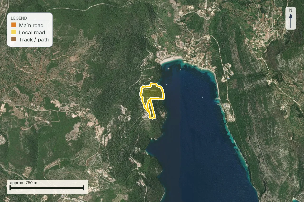
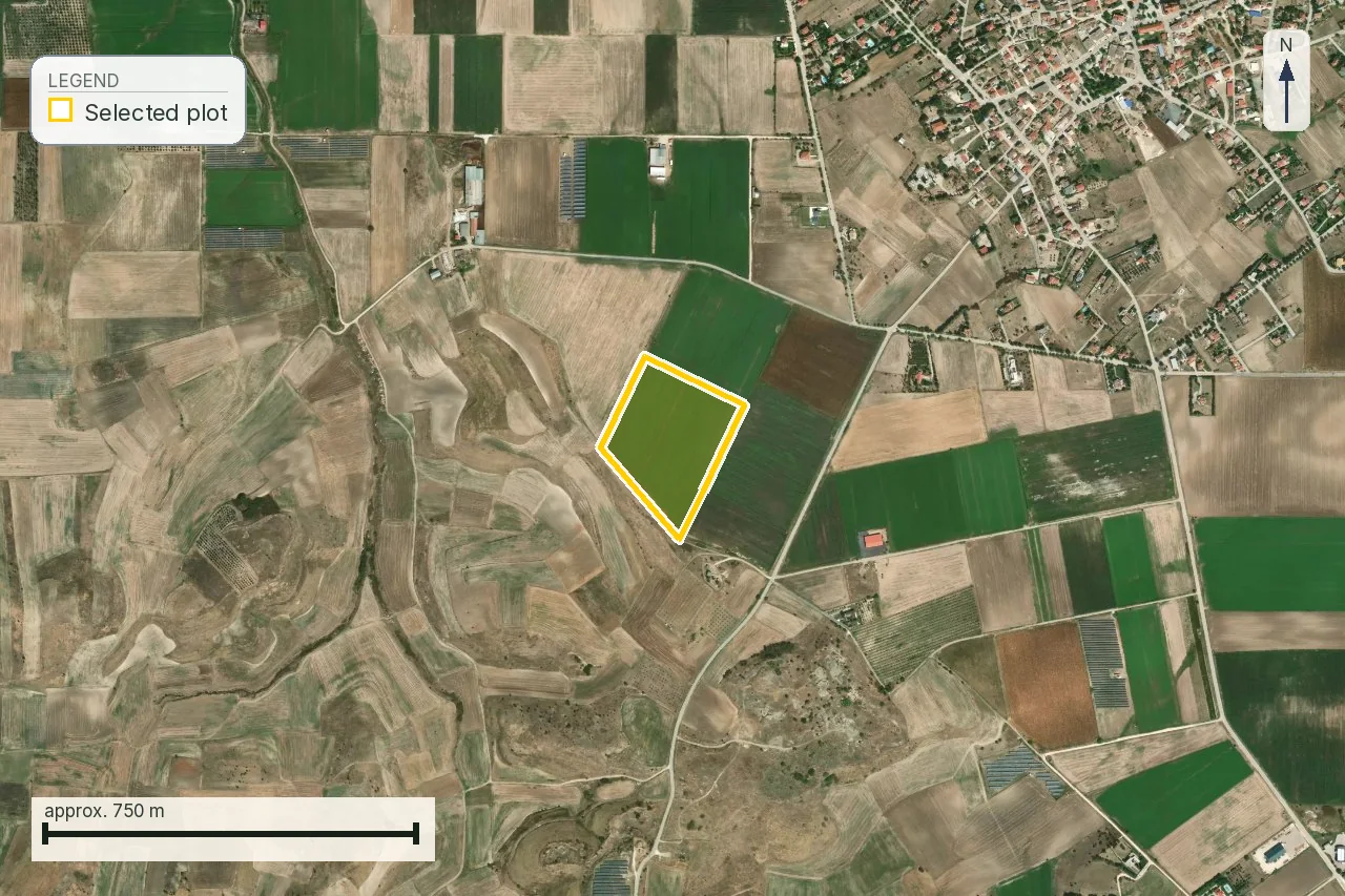
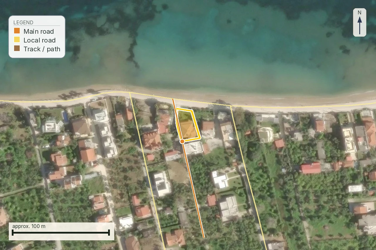
Look at the two ends of that range. At Πόρος on Lefkada four separate tracks come up to the boundary and one runs alongside 113 m of it, which is as close as any of the six gets and settles nothing: a track is a description of a surface, and the plot has no established frontage. At Τερψιθέα nothing mapped comes within 198 m of a 5.7-hectare field, and the plot at Trikeri, which the road does touch, sits inside a ratified forest polygon that closes the question before access ever decides it.
Six parcels cannot measure a market, and this page will not pretend otherwise. Ours are six plots we hold as fixed examples, picked for spread of region and type and not by any sampling method, so nothing here supports a percentage about Greek land. What the six do show is narrower but useful: on none of them have we established that any road there is recognised as κοινόχρηστη. The distances run from a boundary a track touches to 198 m of open field, and the state of the access question is the same at both ends.
That is the scope of our report on this question. Before you pay anyone, it tells you whether the plot in front of you is one where frontage is a live problem, and it puts the nearest mapped road, its class and its distance on a map your engineer can start from. Naming that road in a form a ΥΔΟΜ will accept is his job on the topographic diagram: OpenStreetMap frequently holds no name at all for the line we measure to.
The road that predates the state: what the 1924 route actually involves
Of the routes by which a rural road is treated as public, the one that comes up most often on older land is proof that the road existed before 16 April 1924, in the compiler’s words «16-4-24, ημερομηνίας ισχύος του Νομοθετικού Διατάγματος του 1923», the date the 1923 town-planning decree is said to have taken effect.
We went and checked that date, because it decides whether a file should be opened. The decree is the ν.δ. της 17.7.1923, published at ΦΕΚ Α´ 228/16.8.1923. Its closing articles do not carry 16 April 1924: άρθρο 84 repeals the earlier building rules and άρθρο 85 provides for the decree to be extended to places gradually, by ministerial act, instead of fixing one commencement date for the country. So the date is a convention of professional practice with a real decree behind it and no single clause we could find that states it, and your lawyer works to the date the ΥΔΟΜ applies. What the route stands for is not in doubt. A road that was there before the state began fixing roads by act is not judged by whether an act exists, which is why village lanes nobody ever formally created are public.
One warning attaches to this route in particular, and it comes from ΣτΕ 848/2018 above. The proof is half the work. The act that turns the proof into a recognition has to come from the organ competent to sign it, and in that case a Νομάρχης recognised a rural road as predating 1923 and the recognition was annulled for want of competence. A seller who produces a recognition of exactly this kind is producing a document whose signature you check before its contents.
Where the land came out of a state distribution or a land consolidation, a διανομή or an αναδασμός, which covers a good deal of the arable plain, the road you are arguing about is usually drawn on that plan, and the plan is not in the planning office. It sits with the Περιφέρεια, in the Διεύθυνση Πολιτικής Γης and its Τμήμα Εποικισμού και Αναδασμού, the service that executed the work and keeps the κτηματολόγιο and survey material for it. Ask for the sheet by village and year before you commission a wider archive search.
Proving it is documentary archaeology, and you need to know what that means before you agree to fund it. The work is done by a lawyer with an engineer, it runs to months, and it can fail after you have paid for it. There is no published tariff, because the effort depends on what survives in the archives for that village, so ask for a written quote with a ceiling before you commission anything, and ask what happens to the fee if the file comes back empty. That is a legitimate reason to walk away from a plot whose only route to frontage is this one, and a legitimate reason to reprice it if you stay.
Who can answer which part
Access is the question on which the most people will offer you an opinion and the fewest can produce a document.
The split matters because of the order it forces. The seller answers immediately and means nothing; the ΥΔΟΜ must issue the βεβαίωση όρων δόμησης within ten days of the application, and its answer is the one that decides whether a permit can proceed. Commission it before the deposit, not before the viewing. If you run the process in the order the conversation naturally takes, agent then viewing then deposit then engineer, you will have committed money before that answer arrives. Run it the other way and the worst case is that you paid an engineer a few hundred euro to tell you not to buy.
Reading a listing, phrase by phrase
| What it says | What to ask |
|---|---|
| “Access via agricultural road” | Is that road κοινόχρηστη, and on what basis? An αγροτική οδός describes a use; the legal class is a separate finding. |
| “Road frontage” / «πρόσωπο σε δρόμο» | Which road, by name, and which act classifies it, and which organ signed that act: the π.δ., the ministerial or old nomarchic decision, the ratified πολεοδομική μελέτη. A name on its own answers nothing; you need both. Not the πράξη χαρακτηρισμού of the forest law, which answers a different question about the land itself. Ask in writing from the ΥΔΟΜ or the municipality, and treat the answer as where your lawyer starts. |
| “Right of way agreed with the neighbour” | That is a δουλεία διόδου at best. Useful for a car, worthless for a permit. |
| “The road is being made public” | By which act, at what stage, with what reference number? “Being made” is not a status. |
| “The neighbour will give you a strip” | Private will. ΣτΕ Ολομ. 176/2023 is directly on this. |
| “There is a permit on the plot next door” | Their file may predate the tightening, or use frontage your plot does not share. |
What to do, in order
- Get the road named on the topographic diagram. A διάγραμμα that shows an unlabelled line reaching the boundary has settled nothing.
- Ask the ΥΔΟΜ in writing whether that road is κοινόχρηστη for the purposes of πρόσωπο, and under which act. Your engineer does this; it is not a phone call.
- Have the lawyer read the answer against the title chain. If the answer rests on a municipal recognition, that is the point at which you want a considered written opinion, and a reassurance over the phone will not do.
- Only then negotiate. A plot without frontage is worth agricultural money, and the gap between that and the asking price is the whole negotiation.
Order matters here more than anywhere else in the process. The ΥΔΟΜ must issue the βεβαίωση όρων δόμησης within ten days of the application, so commission it before the deposit. Paying while you wait still means committing money before the answer is in hand.
If the ΥΔΟΜ says no
A refusal on frontage is an εκτελεστή διοικητική πράξη, and there is a route against it with a short clock on it. Under άρθρο 459 παρ. 5–6 ν. 5306/2026, which codifies the former άρθρο 23 ν. 4495/2017, administrative appeals against acts or omissions of a ΥΔΟΜ in the course of issuing a permit, a δόμηση licence or a προέγκριση are heard by the Περιφερειακό Συμβούλιο Πολεοδομικών Θεμάτων και Αμφισβητήσεων (ΠΕ.ΣΥ.ΠΟ.Θ.Α.) of the region, five members chaired by a πάρεδρος of the Νομικό Συμβούλιο του Κράτους. Four things about it decide whether you still have a case in two months.
- Thirty days, and παρ. 5 calls the period αποκλειστική. It runs from service of the act or from the day you otherwise obtained full knowledge of it. There is no extension and no restoration.
- You file it at the ΥΔΟΜ that refused you, at its πρωτόκολλο; that office writes the εισηγητική έκθεση and forwards the file. Filing at the ΠΕ.ΣΥ.ΠΟ.Θ.Α. direct is the standard way to miss the deadline.
- A παράβολο of 50 euro. Άρθρο 459 παρ. 6 puts it in the statute itself: «Για το παραδεκτό της άσκησης προσφυγής απαιτείται καταβολή παραβόλου ύψους πενήντα (50) ευρώ». Without it the appeal is inadmissible, whatever its merits.
- Then it moves on a timetable: the hearing is set within thirty days of the file reaching the council, you are summoned at least ten days before it, and the decision issues within thirty days of the hearing.
After that the route is judicial: an αίτηση ακυρώσεως, within the sixty days of άρθρο 46 παρ. 1 π.δ. 18/1989. Both routes attack the refusal. Neither of them establishes that the road is κοινόχρηστη, which is the thing you actually need, so in most files the appeal is worth lodging only to hold the deadline open while the real work is assembled: the classification act, or the evidence that the road predates the state. Ask your lawyer which of the two you are doing before you pay for either.
If it cannot be cured
A plot without πρόσωπο still has a value. Frontage is one gate among several, so what remains is whatever the rest of the file allows. On most such plots that is agricultural use: worked, held, let, planted, passed on. It is not automatic, because a ratified forest polygon, an archaeological zone, a Ζ.Ο.Ε. or a Natura designation restricts those uses on its own terms and one of our six examples, Trikeri, sits inside a forest polygon. What none of them allows is a house. You will also meet from the next buyer the resistance you are applying now, so price the plot for what it can carry and ask your engineer which of the gates, if any, could still be opened.
Common questions
Does a dirt road give πρόσωπο?
It can. Surfacing is not the test at all. A dirt road whose public character is established gives πρόσωπο, and a newly laid private drive does not. What matters is whether the road is legally κοινόχρηστη, which is answered in documents rather than on a site visit.
I have a registered right of way. Is that enough?
No. A δουλεία διόδου is a real right over a neighbour's land and it does exactly one thing: it gets you across. The strip stays private, so the plot still has no frontage onto a public road. This is the most common false comfort in out-of-plan purchases.
The neighbour is willing to concede a strip for access. Does that solve it?
No, and ΣτΕ Ολομ. 176/2023 is directly on the point: an out-of-plan plot is buildable only where it has, among other things, «πρόσωπο σε κοινόχρηστο χώρο (δρόμο) νομίμως υφιστάμενο», and the court's published summary continues that such a road must not have arisen from private will. The full text of the 2023 decision has still not been published, so we give that second half as the court's holding and not as its exact words. Two three-judge decisions we did read in full, ΣτΕ 665/2018 and ΣτΕ 848/2018, write the same formula out as «δομήσιμα είναι τα γήπεδα που έχουν πρόσωπο σε κοινόχρηστο χώρο νομίμως υφιστάμενο, μη προκύψαντα από ιδιωτική βούληση», which is why we treat the wording as settled even with the Plenary's own text unpublished. Both were read on nomosphysis.org.gr, a private reproduction of the decisions, and not on the Court's site. A strip conceded by a neighbour arises from private will by definition, however formally it is documented.
My plot is landlocked. Can I force a way through under the Civil Code?
You can force a way through, and it will not give you frontage. Άρθρο 1012 ΑΚ gives the owner of a plot that «στερείται την αναγκαία δίοδο προς το δρόμο» a claim against the neighbours against compensation, and άρθρο 1013 leaves the route, the extent of the right and the compensation to a court rather than to agreement. Two limits: άρθρο 1014 refuses the claim where the owner's own act or omission cut the access off, and άρθρο 1015 puts the burden on the seller's remaining land where a part-sale did. What the claim produces is a right of passage over private land, which is the same legal object as a negotiated δουλεία διόδου. Useful for a car, no use for a permit.
The municipality says the road is public. Is that the answer?
It is not the answer, and on its own it is barely evidence. ΣτΕ 273/2016, which we read in full, holds that no provision gives the organs of a δήμος or κοινότητα competence to characterise a road as δημοτική or κοινοτική, that any such act «δεν αποτελεί εκτελεστή διοικητική πράξη, αφού δεν έχει καμία νομική συνέπεια, ούτε δεσμεύει την πολεοδομική υπηρεσία», and that the planning service settles the point παρεμπιπτόντως when it rules on a permit, while a genuine dispute over κοινοχρησία belongs to the civil courts. ΣτΕ 665/2018 and ΣτΕ 848/2018, also read in full, annul a δημοτικό συμβούλιο and a νομάρχης respectively for want of competence, and add the transitional rule: case-by-case recognition is tolerated until the road network is planned as a whole, but by act of the competent state planning organ. So the question to ask about a recognition document is which organ signed it. Get the resolution in writing anyway, and get an opinion rather than a reassurance.
How much frontage does an out-of-plan plot need?
Twenty-five metres. Άρθρο 251 παρ. 1 περ. α΄ ν. 5306/2026 requires «ελάχιστο εμβαδόν γηπέδου τέσσερις χιλιάδες (4.000) τ.μ. και πρόσωπο σε κοινόχρηστο δρόμο είκοσι πέντε (25) μ.», and the same provision excuses only the farm and water buildings of άρθρα 252–253 served by an αγροτικός or δασικός δρόμος, and mountain refuges. The figure comes back in writing on the βεβαίωση όρων δόμησης of άρθρο 324 παρ. 2 περ. β΄, which the ΥΔΟΜ must issue within ten days of the application. The old derogation tiers for small plots each carried their own stated minimum, and those are closed to new entrants.
Your report says the nearest road is 1 m. Why is that not enough?
Because we measure the road network, and there is no legal register to measure. The distance and the class come from OpenStreetMap, which records surface and use. A short distance is a reason to ask the ΥΔΟΜ the question; it is not the answer to it. A long distance is not the answer in the other direction either: it tells you the nearest road OpenStreetMap carries is far away, and at Terpsithea a field track runs along the boundary that OpenStreetMap does not hold at all. Read a large figure as a warning to look at the ground. On that particular 1 m: our summary table carried 28 m for the same job and the two are measured from different origins. The map figure is from the parcel boundary, where the true gap is 0.4 m and the code prints a one-metre floor; the 28 m is from the point the report was ordered on, which sits inside the plot 18 m from its own edge. The road touches the plot, and the table has been corrected.
Does the plot next door having a permit prove anything?
Not on its own. Their file may have been opened before the case law tightened, or may rely on frontage along a different boundary that your plot does not share. Ask about a permit next door: it tells you which road was accepted and under what act, but it is a lead rather than a precedent.
Can a plot without frontage be sold at all?
Yes. It transfers like any other land, and on most such plots what is left is agricultural use: worked, let, planted, inherited. Check that before you price it on that basis, because a ratified forest polygon, an archaeological zone, a Ζ.Ο.Ε. or a Natura designation restricts those uses on its own terms and independently of frontage. What none of them allows is a building. Expect from the next buyer the resistance you are applying now; we publish no figure for the price gap, because we have no sampling behind one.
Keep reading
Check this on your own parcel
Pin the plot, confirm the KAEK, and every check in this guide is read against it and written up with its source and date. EUR 39 total · VAT included.