
Διαβάστε το άρθρο στα ελληνικά.
Streams and ρέματα in Greece: the setback a map cannot invent
On this page
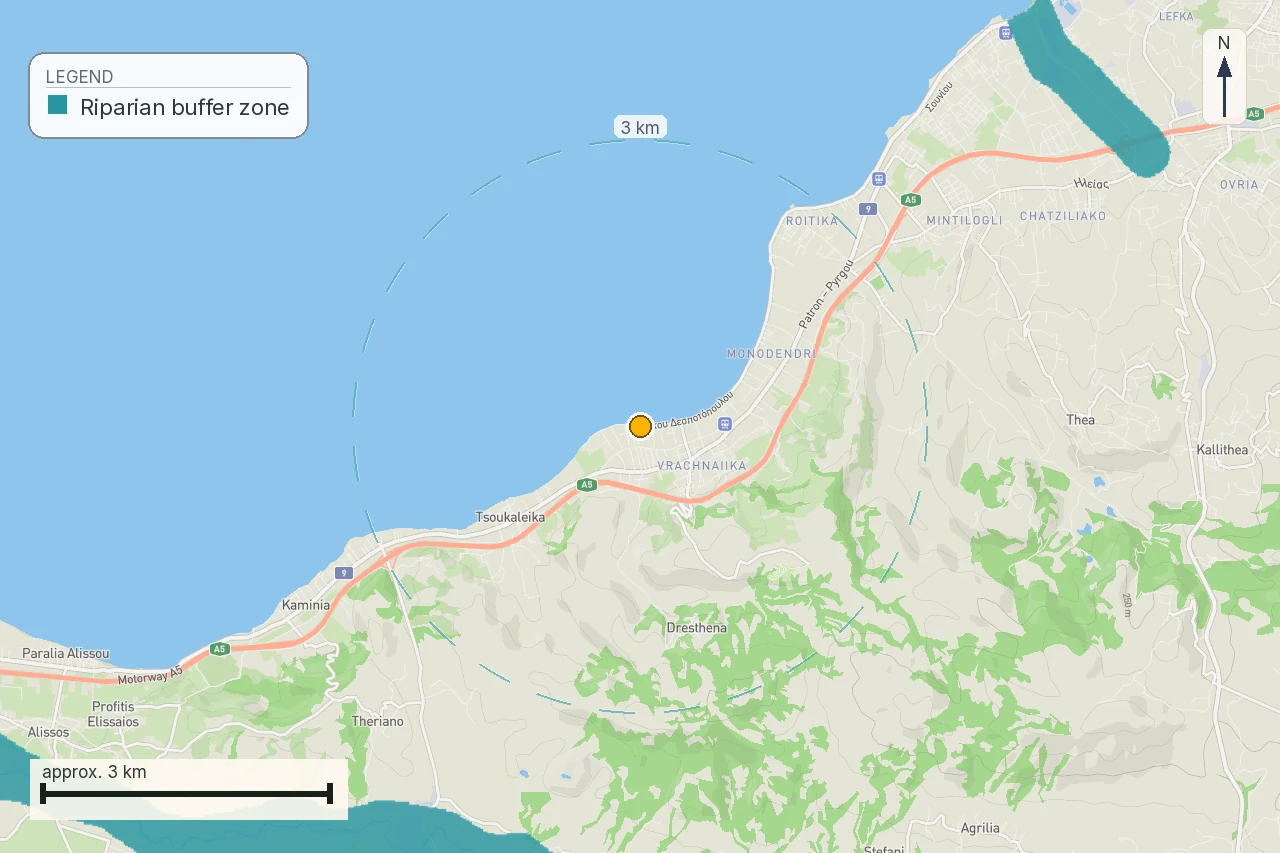
The parcel at Νέα Προποντίδα, Χαλκιδική is close to an official modelled flood corridor. The buyer's next question is the stream act, its lines and its stage, not a number copied from a flood map.
This guide is a preliminary screen for a purchase or permit question, not legal, surveying, engineering or tax advice; read the full scope and limits before relying on it.
The parcel at Νέα Προποντίδα, Χαλκιδική is 601 m² at KAEK 490450120002. Its elevation is 3.0 m, and the official flood record places a corridor within approximately 16 m. That is enough to make the stream file a purchase question. It is not enough to give a buyer a setback number. Start with the Greek flood-zone guide and the topographic-diagram guide, then follow the legal line that those map pages cannot draw for you.
The parcel is a location problem before it is a distance problem
A listing can describe a dry swale, a seasonal ditch or a line of reeds. In summer, a natural watercourse may look like a shallow depression with no visible flow. The definition in article 1 paragraph 1 of Law 4258/2014 covers natural or arranged formations that receive surface runoff. The flood research also records that a permanent flow is not required. An irrigation or drainage ditch is treated separately in that same definition. A visit on a dry day therefore supplies useful observation, while it leaves the legal classification open.
For this one, the facts are unusually plain. The land is almost level, the elevation is close to sea level, and a public flood corridor is close enough to require a second question. The public layer tells us where the modelled water extent comes near the polygon. It does not identify the natural bed, the two banks, the two οριογραμμές, or the act that gives those lines legal force.
Begin with the object the map actually shows
The flood research distinguishes the modelled maximum extent from the ΖΔΥΚΠ designation and from a stream delimitation. The first is a water scenario drawn from a hydraulic model. The second is a management area. The third is an act about a particular watercourse and its lines. They may refer to the same drainage system, but their geometry, purpose and legal route differ.
| Public object | What it answers | What the file still needs |
|---|---|---|
| Modelled flood extent | Where the scenario places water | Stream file and project geometry |
| ΖΔΥΚΠ | Which management area is designated | Its act and relationship to the reach |
| Stream delimitation | Where the watercourse lines are ratified | Diagram, publication and survey application |
The practical mistake is easy to make. A buyer measures 16 m from a flood polygon and calls the result "the stream setback." The house then gets priced around that number. A second buyer sees no water on the ground and calls the polygon irrelevant. Both have skipped the act. A distance from the modelled extent is evidence about exposure to the mapped scenario. A distance from an οριογραμμή is evidence about the legal watercourse corridor. One cannot be silently substituted for the other.
Read the 2014 law as a sequence of files
Law 4258/2014 is titled “Procedure for the delimitation and regulation of matters concerning watercourses” and was published in ΦΕΚ Α΄ 94/14.4.2014. Article 1 supplies the vocabulary. Article 2 connects the delimitation dossier to flood-hazard maps. Article 3 describes approval and publication. Article 5 contains the special building route when a completed delimitation is absent. Article 6 provides for the archive and national database of delimitations.
The order matters. A research map can prompt a search. A hydraulic and topographic dossier can establish the proposed lines. The competent service checks the file. The competent authority ratifies it, with a presidential decree route in the special cases named by article 3 paragraph 4. The buyer should ask which of those events has occurred for the reach affecting the parcel. “The stream is shown on a portal” is a starting description, not a stage.
Why a ratified corridor is a different finding
Article 1 paragraph 9 calls the two boundary lines the οριογραμμές. Article 1 paragraph 12 calls the strip between them the ζώνη υδατορέματος. Article 5 paragraph 3β treats that zone as an area outside urban planning. The buyer's file must therefore place the parcel, intended building, driveway and utility routes against the actual lines. A fence, a filled edge or a convenient access path cannot move the natural bed in the legal file.
The result is a geometry task. The word “near” is too coarse. The deed polygon, the current topographic survey, the natural bed, each οριογραμμή and the intended works need a common reference system. If the act is old, the engineer must also resolve how its diagram sits against the current parcel. If the public viewer shows a line without the act or publication details, record that as an unresolved source, not as a final boundary.
Article 5 gives a project route when the line is missing
Article 5 paragraph 2 addresses the case where a stream has no completed delimitation and a permit is being pursued. It requires a hydraulic study of the upstream catchment and the definition on a topographic diagram of the flood lines for a fifty-year period. The Technical Service of the Region checks and endorses that work. Building is then described outside those flood lines and the banks, at distances determined under the building code route named by the provision.
That paragraph is a route for a defined project. It is not permission to copy the edge of a national flood polygon into a listing, and it is not a permanent national metre table. Law 4067/2012 names the underlying building-code route without printing a figure. Law 5306/2026, article 225 paragraph 1, replaced it and requires a presidential decree to set the terms and conditions of building near streams; as of this reading, that decree had not been issued. This page therefore prints no universal setback number.
The 20 m and 50 m figures belong to another route
Buyers often encounter 20 m and 50 m in conversations about streams. Article 374 of Law 5306/2026 keeps those figures separate: it uses deemed provisional lines exclusively for the regulation of existing unauthorised structures. It bars regularisation inside the boundaries of a delimited stream. Those figures do not become a general new-house setback merely because they are convenient to repeat.
For this parcel, the safe question is therefore not “is the plot 20 m away?” It is “which line, from which act, measured in which coordinate system, controls this proposed house?” The engineer can answer the geometry after the document search. The seller cannot answer it, and neither can a screenshot or a dry-season site visit.
What the dated reading established
On 1 August 2026, the parcel's record was read together with the flood research record. It established the KAEK, the 601 m² area, the 3.0 m elevation and the official flood corridor within approximately 16 m. On 4 August 2026, the legal source register was checked against Law 4258/2014, ΦΕΚ Α΄ 94/14.4.2014, with attention to article 5 “Special provisions”. The resulting finding is precise: the parcel is close enough to a modelled water extent to require the stream file, while the public reading used here does not establish a ratified οριογραμμή or a metre setback for the parcel.
This is a useful risk signal. It does not say that a house is prohibited. It says the house footprint cannot be priced as settled until the line, the act and the building route are attached to the same survey. If the owner says that no water has been seen for years, ask for the catchment evidence and the act. If the map says flood corridor, ask which stream reach and which legal document connects the two.
Use the survey to test the proposed house
The survey request should be specific. Ask for the parcel boundary as used by the current title and for the source of the boundary coordinates. Ask the hydraulic engineer to identify the natural bed and the two banks, and to show every available οριογραμμή or flood line. Ask the architect to draw the building envelope, access, retaining works and service trenches on that same sheet. Ask the planning engineer to state which line is being used for the permit analysis and where the supporting act is filed.
This makes disagreement visible. A portal polygon can be wider than a legal corridor. An old diagram can sit differently from a new survey. A proposed driveway can cross a line that the house itself avoids. A wastewater route can reach the stream even when the bedroom does not. Each is a separate geometry question, and the buyer should receive the answer in writing.
Ask the Region for the file, not a verbal reassurance
The research assigns the stream delimitation file to the competent regional and administrative authorities, with the Technical Service of the Region involved in the hydraulic check under article 5. The buyer should ask for the diagram, the operative act, the ΦΕΚ or other publication detail, the date, the reach covered and any later correction or amendment. Ask where the record is registered and whether the displayed line is a proposal, an approved line or a line that has been ratified.
The answer should identify a document. “The municipality knows the stream” is helpful only as a direction to the right office. It does not replace the file. If the office cannot locate a ratified delimitation, ask whether a project-specific hydraulic route is available and what the service needs to review it. Put the request in writing so the purchase file shows what was asked and when.
A dry channel still needs a classification answer
Article 1 does not make the presence of water on inspection day the test. Seasonal flow belongs to the subject. At the same time, a man-made drainage or irrigation ditch is excluded from the statutory definition cited in the research. These facts create a professional question, not a shortcut. The hydraulic engineer should trace the upstream catchment and the downstream continuation, inspect the morphology and explain why the feature is or is not the watercourse in the act.
For this parcel, this question is more useful than a photograph taken in August. Keep photographs as dated evidence of current conditions. Give them to the engineer with the cadastral polygon and the flood layer. Do not let a dry surface erase a receiving channel, and do not let a straight blue line in a viewer prove a natural bed without the source record.
When the stream file touches access and utilities
A buyer often checks only the house. The project also needs an entrance, water, power, wastewater and drainage. Article 5's building rule is framed around the building location, while the rest of the file can still be affected by the watercourse. A road crossing, a culvert, a retaining wall or a pipe route can require its own hydraulic and environmental review. The engineer must show those elements before the buyer treats a distant house footprint as a solution.
That is why a report should carry a parcel map and an explicit missing-data checklist. For this parcel, the public evidence establishes the nearby modelled corridor. The missing items are the legal status of the stream reach, the exact οριογραμμές, the supporting publication, the flood-line treatment for the proposed works and the professional opinion on the access and utility routes. A green “map checked” label would conceal the decision that still remains.
Put the open questions into the purchase condition
The deposit discussion should name the documents. A buyer can ask that the seller provide the current survey and the stream act before the deposit becomes unconditional. If the act is absent, the agreement can refer the parties to the engineer's written feasibility opinion and to the required administrative route. A lawyer should draft the condition. This article does not create a contract term, and it does not decide whether a particular condition is enforceable.
The commercial point is simple. A plot with an unresolved stream line carries a different preflight risk from a plot with a ratified diagram that has already been applied to the proposed house. The difference may affect design, access, drainage, timing and price. It deserves a document in the file before money makes the question harder to ask.
Questions for the engineer and authority
- Which natural formation and catchment does the public flood corridor near this parcel represent?
- Are the two banks and both οριογραμμές shown on a current survey tied to KAEK 490450120002?
- Does a ratified delimitation act cover this reach, and where are its act number, date and publication?
- If the reach has no completed delimitation, can article 5 paragraph 2 be used for the intended house?
- Who checks the hydraulic study, and what does the Technical Service of the Region require?
- Which line controls the house, driveway, retaining works, drainage and wastewater route?
- Does any later correction, amendment or special protection status change the ratification path?
- What exact document lets the buyer move from a map signal to a design decision?
The decision gate
There are three sensible states. The file may contain a ratified act and publication, in which case the team applies the corridor to the survey. It may contain no act but a viable project route, in which case the buyer commissions the hydraulic work before pricing the house. Or the available geometry may conflict, in which case the footprint pauses while the professionals resolve the line. Each state is more informative than a confident number copied from a map.
What the map does not confirm
The official flood evidence can show that the parcel is close to a modelled corridor and can direct attention to the water system. The flood research says that the modelled extent and the ΖΔΥΚΠ answer different questions. The stream law supplies the separate vocabulary of bed, banks, οριογραμμές, zone and delimitation procedure. None of those readings, by itself, supplies a parcel-specific permit decision.
The article also does not establish that sitting inside a mapped flood extent alone makes land unbuildable. The research records that conclusion as unverified and keeps the effects indirect. For a buyer, the useful consequence is a disciplined request: identify the layer, identify the act, identify the line, identify the intended works and obtain the professional application.
Scope of this page
This page follows the parcel, KAEK 490450120002, at Νέα Προποντίδα, Χαλκιδική. It explains the difference between a modelled flood extent and a delimited stream corridor, the 2014 delimitation route and the evidence needed before a house is designed. It does not certify ownership, legal buildability, the existence of a sewer, the quality of a survey or the outcome of an authority review. LandCheck is a property preflight report, not legal, surveying, hydraulic, architectural or engineering advice. The buyer should use a Greek lawyer and the appropriate engineer before signing or paying a deposit.
Common questions
Is a flood corridor the same thing as a stream setback?
No. The modelled flood extent and the delimited stream corridor come from different public objects. The parcel's ~16 m finding opens the stream-file question; it does not supply a legal setback.
What does the ~16 m result for this parcel actually measure?
It is the reported proximity to an official modelled flood corridor in the parcel research record. It is not a measurement from an οριογραμμή taken from a ratified stream diagram.
Can a stream be legally relevant when the bed is dry?
Yes, a natural watercourse may have intermittent flow. The engineer still has to distinguish it from an irrigation or drainage ditch under the definition recorded for article 1.
Where do the two οριογραμμές appear?
They should appear in the delimitation material and be applied to a current survey. Ask for the diagram, the act, its publication and the reach covered before relying on their position.
Does Greek law publish one metre distance for every new house near a stream?
No single national metre figure is established. Article 5 refers to the building-code route, and the applicable local act and project file still need checking.
Are the 20 m and 50 m figures the new-house rule?
No. Article 374 of Law 5306/2026 places them in a separate route for existing unauthorised structures and provisional lines. Do not use them as a universal new-build answer.
What does article 5 require when a parcel has no completed delimitation?
For a permit route, it describes a hydraulic study of the upstream catchment, T=50 flood lines on a topographic diagram and review by the Regional Technical Service.
Which documents should I request before paying for a parcel like this?
Request the current survey, the stream diagram and operative act, publication details, any amendment, and a written engineer opinion applying the lines to the house, access, drainage and services.
Can the public flood map decide whether a parcel is buildable?
It can identify a material preflight signal. The research does not establish that a mapped flood extent alone decides buildability; the stream act, planning file and project geometry remain open.
Keep reading
Check this on your own parcel
Pin the plot, confirm the KAEK, and every check in this guide is read against it and written up with its source and date. EUR 39 total · VAT included.